Skookumchuck, British Columbia facts for kids
Quick facts for kids
Skookumchuck
|
|
|---|---|
| Country | Canada |
| Province | British Columbia |
| Region | East Kootenay |
| Regional district | East Kootenay |
| Area code(s) | 250, 778, 236, & 672 |
| Highways | |
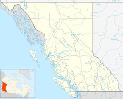
Skookumchuck is a small place in the East Kootenay region of southeastern British Columbia, Canada. It is located right on the Kootenay River, where two main highways (93 and 95) meet. Skookumchuck is about 54 kilometers (33 miles) north of Cranbrook and 193 kilometers (120 miles) southeast of Golden.
Contents
What Does Skookumchuck Mean?
The name Skookumchuck comes from Skookumchuck Creek. In the 1880s, people described this creek as a "stream of the rapid torrent." This means it was a fast-moving stream. Gold prospectors built cabins near the creek, which is about 2 kilometers (1 mile) west of where the Skookumchuck bridge is today.
Before the bridge was built in the 1920s, the community on the east side of the river was called Springbrook. The area on the west side was known as Skookumchuck. When the communities joined together, they decided to use the name Skookumchuck.
How People Travelled in Skookumchuck
For over a hundred years, since the 1890s, people in Skookumchuck have used roads and railways to get around. This is similar to how people travelled in nearby places like Wasa, British Columbia.
Life in Skookumchuck
At first, people came to Skookumchuck for mining and logging jobs. When train service started in 1915, more people moved to the area. John W. Blake was the first postmaster, managing the mail from 1915 to 1921. By 1918, he also ran a general store near the train station. However, many early residents soon moved to other areas.
Around 1940, new log cabins and a log grocery store were built in the Springbrook area. In the mid-1960s, a two-story motel was added. The original log store unfortunately burned down in the mid-1970s, but a new one was built across the highway. In 1967, the community got its own telephone exchange, making communication easier.
The Skookumchuck Pulp Mill
A big change happened in 1968 when the Skookumchuck Pulp Mill was built near the creek. This brought many new homes and people to the area. The mill has been updated several times over the years to improve its operations. In 2001, a special woodwaste cogeneration plant opened. This plant uses wood waste to create energy.
In 2013, a company called Paper Excellence Canada Holdings bought the mill. In 2021, the mill was fined for releasing too much treated wastewater and air emissions.
Today, Skookumchuck has a convenience store with a gas station, and a motel that also offers RV parking and camping spots.
Schools in Skookumchuck
Historically, the area known as Skookumchuck included places about 2 miles (3 kilometers) around the train station.
Larchwood School
Larchwood school was considered part of Skookumchuck. It was located about 1.2 kilometers (1 mile) east of Larchwood Lake. Classes for children of mill workers began there in 1921. Over the years, students attended classes in different schoolhouses and residences. By 1938, the school moved closer to the Skookumchuck train station. Children from a nearby place called Torrent also attended. The last school year for this location was 1943-1944.
Premier Lake and Springbrook Schools
In 1906, Sam Cadieux settled near Sheep Creek (now called Lussier River), about 3 kilometers (2 miles) north of Premier Lake. This spot was a stop for stagecoaches. A school existed near Premier Lake from 1932 to 1952. A new school building was built there in 1949. During this time, a school bus picked up students from Springbrook.
In 1952, a new portable building for Springbrook Elementary replaced the old log-cabin school at Sheep Creek. Springbrook school then closed in 1957.
 | Stephanie Wilson |
 | Charles Bolden |
 | Ronald McNair |
 | Frederick D. Gregory |


