Smithton, Illinois facts for kids
Quick facts for kids
Smithton
|
|
|---|---|

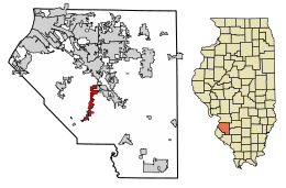
Location of Smithton in St. Clair County, Illinois.
|
|

Location of Illinois in the United States
|
|
| Country | United States |
| State | Illinois |
| County | St. Clair |
| Area | |
| • Total | 4.49 sq mi (11.62 km2) |
| • Land | 4.43 sq mi (11.49 km2) |
| • Water | 0.05 sq mi (0.14 km2) |
| Elevation | 476 ft (145 m) |
| Population
(2020)
|
|
| • Total | 4,006 |
| • Density | 903.27/sq mi (348.79/km2) |
| Time zone | UTC-6 (CST) |
| • Summer (DST) | UTC-5 (CDT) |
| ZIP Code(s) |
62285
|
| Area code(s) | 618 |
| FIPS code | 17-70252 |
| GNIS feature ID | 2399833 |
| Wikimedia Commons | Smithton, Illinois |
Smithton is a small village located in St. Clair County, Illinois, in the United States. It's a part of the larger Metro East area, which is close to Saint Louis, Missouri. In 2020, about 4,006 people lived there.
Where is Smithton Located?
Smithton is found at coordinates 38.405800 degrees North and -89.992578 degrees West. This means it's in the northern hemisphere and west of the Prime Meridian.
The village covers a total area of about 3.86 square miles. Most of this area, about 3.82 square miles, is land. The remaining small part, about 0.04 square miles, is water.
Who Lives in Smithton?
The number of people living in Smithton has grown quite a bit over the years. Here’s a quick look at how the population has changed:
| Historical population | |||
|---|---|---|---|
| Census | Pop. | %± | |
| 1880 | 400 | — | |
| 1890 | 411 | 2.8% | |
| 1900 | 405 | −1.5% | |
| 1910 | 380 | −6.2% | |
| 1920 | 357 | −6.1% | |
| 1930 | 361 | 1.1% | |
| 1940 | 448 | 24.1% | |
| 1950 | 515 | 15.0% | |
| 1960 | 629 | 22.1% | |
| 1970 | 847 | 34.7% | |
| 1980 | 1,447 | 70.8% | |
| 1990 | 1,587 | 9.7% | |
| 2000 | 2,248 | 41.7% | |
| 2010 | 3,693 | 64.3% | |
| 2020 | 4,006 | 8.5% | |
| U.S. Decennial Census | |||
In the year 2000, there were 2,248 people living in Smithton. These people lived in 786 households, and 605 of these were families. The village had about 1,344 people per square mile.
Most people in Smithton identified as White (97.46%). A smaller number identified as African American (0.76%), Native American (0.36%), or Asian (0.40%). Some people (0.98%) identified with two or more races.
Many households (41.0%) had children under 18 living with them. About 64.0% of households were married couples. The average household had about 2.74 people, and families had about 3.16 people.
The population included people of all ages. About 27.1% were under 18, and 12.4% were 65 or older. The average age in the village was 35 years old.
In 2000, the average income for a household in Smithton was $51,806 per year. For families, the average income was $59,875.
Smithton Public Library
The Smithton Public Library District serves the village and the surrounding area. It first opened its doors in July 1993.
This library is part of the Lewis and Clark Library System. This means that people with a library card can borrow books from many other libraries in the system.
The library gets most of its money from public taxes. It also receives donations and earns money from things like book sales.
The library has a collection of over 17,000 items. These include books, magazines, audiobooks, music CDs, and movies. In 2011, it was one of the first libraries in the area to let people check out eBook readers.
See also
 In Spanish: Smithton (Illinois) para niños
 | Anna J. Cooper |
 | Mary McLeod Bethune |
 | Lillie Mae Bradford |

