Snake Creek (Provo River tributary) facts for kids
Quick facts for kids Snake Creek |
|
|---|---|
|
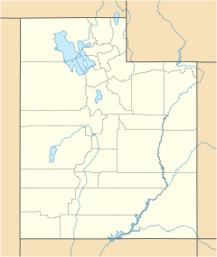
Location of the mouth of the Snake Creek in Utah
|
|
| Country | United States |
| State | Utah |
| County | Wasatch |
| Physical characteristics | |
| Main source | Wasatch Mountains Southeast slope of Sunset Peak, Wasatch Mountains, Wasatch County, Utah 8,579 ft (2,615 m) 40°34′31″N 111°35′06″W / 40.57528°N 111.58500°W |
| River mouth | Confluence with middle section of the Provo River, above Deer Creek Reservoir Provo, Utah County, Utah 5,430 ft (1,660 m) 40°29′01″N 111°28′00″W / 40.48361°N 111.46667°W |
| Basin features | |
| Tributaries |
|
Snake Creek is a stream in Utah. It flows for about 11.7 miles (18.8 km). This creek is a small river that eventually joins the middle part of the Provo River. You can find it in Wasatch County, Utah.
Why is it called Snake Creek?
Snake Creek got its name from a surprising discovery. Long ago, people found a nest of rattlesnakes in some dry "hot pots." Hot pots are like natural bowls or craters. They are formed by hot water springs that create mounds of a soft rock called tufa. The snakes were removed, and the dry hot pot area later became a place where limestone was dug up.
People started mining in Snake Creek Canyon around 1894. A newspaper reporter even wrote about finding a "handsome specimen of copper" there. By 1897, a company called Steamboat began working in the area where Snake Creek starts.
Where does Snake Creek flow?
Snake Creek begins high up on the southeastern side of Sunset Peak. This peak is about 3 miles (4.8 km) south of Brighton.
The creek then flows southeast through Snake Creek Canyon. Along the way, it picks up water from smaller streams. One of these is Lavina Creek, which joins from the left side. Pine Creek also joins the main creek at the bottom of the canyon. This area is part of Wasatch Mountain State Park.
From there, Snake Creek flows south through the city of Midway. It runs along the western edge of the Heber Valley. After passing Midway, Snake Creek meets the middle part of the Provo River. This meeting point is just above the Deer Creek Reservoir.
Protecting Snake Creek
Since 1995, most of Snake Creek Canyon has been protected. This effort started when 758 acres (about 3 square kilometers) of land were bought. Several groups worked together to do this. These groups included Utah Open Lands, the Snake Creek Preservation Society, The Nature Conservancy, and the Utah Division of Parks and Recreation. Later, more land was purchased, bringing the total protected area to 917 acres (about 3.7 square kilometers).
Even though Snake Creek provides only a small amount of water to the Provo River, it can carry some natural elements. These elements, like arsenic, can increase in the Provo River. In the past, farms along the lower part of Snake Creek caused pollution from things like phosphates and nitrates. This pollution affected the lower Provo River and Deer Creek Reservoir. However, a big clean-up effort took place in the 1980s to make the water much cleaner.


