Sombrio River (Canada) facts for kids
Quick facts for kids Sombrio River |
|
|---|---|
|
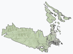
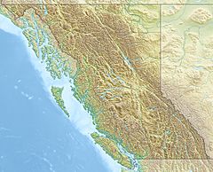
Location of the mouth of the Sombrio River
|
|
| Country | Canada |
| Province | British Columbia |
| District | Capital Regional District |
| Physical characteristics | |
| Main source | unnamed confluence 530 m (1,740 ft) 48°32′28″N 124°15′05″W / 48.54111°N 124.25139°W |
| River mouth | Strait of Juan de Fuca 0 m (0 ft) 48°30′01″N 124°18′05″W / 48.50028°N 124.30139°W |
The Sombrio River is a cool river in British Columbia, Canada. It flows on the southern part of Vancouver Island. This river ends its journey in the Strait of Juan de Fuca, which is part of the Pacific Ocean. You can find its mouth at a place called Sombrio Beach.
Where the Sombrio River Flows
The Sombrio River starts high up in the mountains. It begins where two smaller streams meet. This starting point is about 507 metres (1,663 ft) above sea level.
The river then flows towards the southwest. It goes under British Columbia Highway 14. Later, it passes under a cool suspension bridge. This bridge is part of the Juan de Fuca Marine Trail.
The Sombrio River finally reaches the Pacific Ocean. It flows into the Strait of Juan de Fuca at Sombrio Beach. This spot is north of Sombrio Point. It is also southeast of the small town of Port Renfrew.
Sombrio River and Juan de Fuca Park
A big part of the Sombrio River is inside a special area. This area is called Juan de Fuca Provincial Park. The lower sections of the river, below Highway 14, are protected within this park. This means the river and its surroundings are kept natural for everyone to enjoy.
 | William M. Jackson |
 | Juan E. Gilbert |
 | Neil deGrasse Tyson |


