Soulatgé facts for kids
Quick facts for kids
Soulatgé
|
|
|---|---|

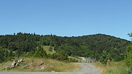
The Col de Redoulade in Soulatgé
|
|
| Country | France |
| Region | Occitanie |
| Department | Aude |
| Arrondissement | Narbonne |
| Canton | Les Corbières |
| Intercommunality | Massif de Mouthoumet |
| Area
1
|
24.16 km2 (9.33 sq mi) |
| Population
(Jan. 2021)
|
Lua error in Module:Wd at line 1,575: attempt to index field 'wikibase' (a nil value). |
| Time zone | UTC+01:00 (CET) |
| • Summer (DST) | UTC+02:00 (CEST) |
| INSEE/Postal code |
11384 /11330
|
| Elevation | 357–932 m (1,171–3,058 ft) (avg. 373 m or 1,224 ft) |
| 1 French Land Register data, which excludes lakes, ponds, glaciers > 1 km2 (0.386 sq mi or 247 acres) and river estuaries. | |
Soulatgé is a small village, also called a commune, located in the south of France. It is home to about 128 people, based on a 2017 count. This charming place is found in the Occitanie region and is part of the Aude department.
Contents
Where is Soulatgé Located?
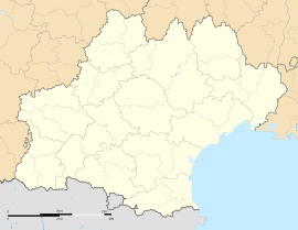
Soulatgé is in the Aude department. This department is in the southern part of France. The region it belongs to is called Occitanie.
What is a Commune?
In France, a commune is the smallest unit of local government. Think of it like a town or a village. Each commune has its own mayor and local council. Soulatgé is one of these many communes.
What is a Department?
A department in France is like a county or a state in other countries. It's a larger area made up of many communes. The Aude department is known for its beautiful landscapes and history.
Local Government and People
Soulatgé has a mayor who helps run the village. The mayor works with a local council to make decisions. These decisions help the community and its people.
In 2017, the village had 128 residents. This makes Soulatgé a very small and quiet place.
Geography and Surroundings
Soulatgé is located in a beautiful area. Its elevation ranges from 357 meters to 932 meters above sea level. This means it has varied terrain, including hills and valleys. The total area of the commune is about 24 square kilometers.
See also
 In Spanish: Soulatgé para niños
 | James Van Der Zee |
 | Alma Thomas |
 | Ellis Wilson |
 | Margaret Taylor-Burroughs |


