South Baldface facts for kids
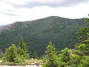
South Baldface is a mountain in Chatham, New Hampshire, located in the eastern part of the White Mountains. It stands about 3,547 feet (1,081 meters) tall. This mountain gets its unique name from its eastern side, which is very steep and has no trees, looking "bald."
South Baldface is a popular spot for hiking, especially during the summer months. It is often explored along with its neighbor, North Baldface. Hikers can reach these mountains using several trails, including the Slippery Brook, Baldface Knob, Baldface Circle, Meader Ridge, and Bicknell Ridge trails.
Exploring South Baldface
South Baldface is known for its challenging but rewarding hikes. Many people visit to enjoy the beautiful views from its rocky, open summit. The trails offer different levels of difficulty, making it a great place for both experienced hikers and those looking for a fun adventure.
Why is it called Baldface?
The name "Baldface" comes from the mountain's eastern side. This part of the mountain is very steep and rocky, with hardly any trees growing on it. This makes it look like a large, bare "face" when seen from a distance, giving the mountain its distinctive name.
Nearby Peaks and Waterways
South Baldface is part of a group of mountains. North Baldface is located just to its northwest. Another mountain, Eastman Mountain, which has some trees, is to the southeast. You can reach Eastman Mountain by a short trail that branches off from the Slippery Brook Trail. To the southwest are Sable Mountain and Chandler Mountain, which are mostly covered in thick forests and do not have marked trails.
The water from the eastern and northeastern parts of South Baldface flows into the Cold River. This river then joins the Saco River, which eventually flows into the Atlantic Ocean. Water from the western and southern sides of the mountain also flows into branches of the Saco River, like the East Branch Saco River and Slippery Brook.
 | Aurelia Browder |
 | Nannie Helen Burroughs |
 | Michelle Alexander |


