Saco River facts for kids
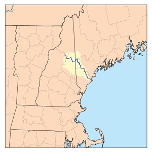
The Saco River is a beautiful river in the northeastern part of New Hampshire and southwestern Maine in the United States. It flows through a large area of forests and farmlands, eventually emptying into the Atlantic Ocean at Saco Bay. The river is about 136 miles (219 km) long.
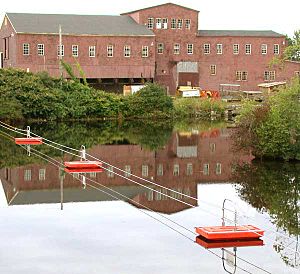
The Saco River is very important! It provides drinking water for about 250,000 people in 35 towns. In the past, it was also used for transportation and to power mills, which helped cities like Biddeford and Saco, and towns like Fryeburg and Hiram, grow.
The name "Saco" comes from the Eastern Abenaki people. The word [sɑkohki] means "land where the river comes out." Old documents from the 1600s called the river Chouacoet.
Quick facts for kids Saco River |
|
|---|---|
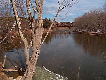
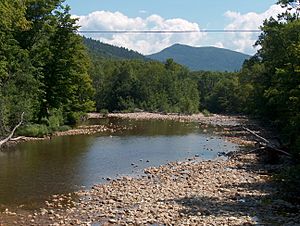
The Saco River in Conway, New Hampshire
|
|
| Country | United States |
| States | New Hampshire, Maine |
| Counties | Coos, NH, Carroll, NH, Oxford, ME, Cumberland, ME, York, ME |
| Towns and cities | Conway, NH, Fryeburg, ME, Saco, ME, Biddeford, ME |
| Physical characteristics | |
| Main source | Saco Lake Crawford Notch, White Mountains, NH 1,887 ft (575 m) 44°12′58″N 71°24′31″W / 44.21611°N 71.40861°W |
| River mouth | Saco Bay, Gulf of Maine, Atlantic Ocean Biddeford/Saco, ME 0 ft (0 m) 43°27′42″N 70°21′20″W / 43.46167°N 70.35556°W |
| Length | 136 mi (219 km) |
| Basin features | |
| Basin size | 1,703 sq mi (4,410 km2) |
Contents
Where the Saco River Flows
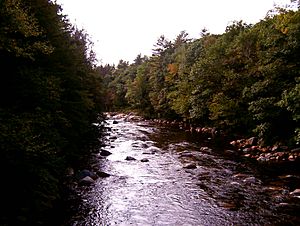
The Saco River starts at Saco Lake. This lake is located in Crawford Notch in the White Mountains of New Hampshire. From there, the river flows mostly south and southeast.
It passes through towns like Bartlett and Conway in New Hampshire. Then, it crosses the border into Oxford County, Maine.
The "Canal River" Shortcut
When the river reaches Fryeburg, Maine, it splits into two paths. One path is the "Old Course" Saco River. The other is called the "Canal River."
The Canal River was built in the 1800s to make it easier for farmers to use the river. It is about 6-mile (10 km) long, which is 15 miles (24 km) shorter than the old course. Today, the Canal River is considered the main path of the Saco River. The two paths join back together near Lovell, Maine.
Journey to the Ocean
The Saco River flows past six hydropower stations. These stations use the river's power to create electricity. Two of these are the Skelton Dam and Bonny Eagle Dam.
After these stations, the river enters York County. It then flows under Interstate 95. Finally, it passes between the cities of Saco and Biddeford. Here, U.S. Route 1 crosses over it on a bridge. The river then reaches Saco Bay in the Atlantic Ocean. On the north side is Camp Ellis in Saco, and on the south side is Hills Beach in Biddeford.
River Flow and Measurements
Scientists keep track of how much water flows in the Saco River. They use special tools called stream gauges.
One stream gauge is in Conway, New Hampshire. At this spot, the river collects water from an area of 385 square miles (1,000 km2). The average water flow here is about 962 cubic feet per second (27.2 m3/s).
Another stream gauge is in Cornish, Maine. Here, the river collects water from a much larger area of 1,293 square miles (3,350 km2). The average water flow at Cornish is about 2,756 cubic feet per second (78.0 m3/s).
Fun Things to Do on the Saco River
The Saco River is a very popular place for outdoor activities! Many people visit it, especially during summer weekends. It's estimated that thousands of people come to enjoy the river.
Beaches and Camping
The Saco River has many sandy beaches, especially when the water level is not too high. You can even camp on some of these beaches for free! However, it's important to be respectful of the land. Always clean up your trash and follow rules about campfires. You need a permit from the State of Maine for campfires on unposted river beaches.
Canoeing and Kayaking
The Saco River is a favorite spot for canoeing and kayaking. There's one area called Walker's Rip with some small rapids. These rapids can be a bit tricky for beginners, but they can be navigated safely. Many places along the river offer canoe and kayak rentals.
Fishing
The Saco River is also known for sport fishing. Even though the number of fish has changed over time, it's still a good place to try and catch some fish.
Challenges and Legends
Sometimes, there have been issues with too much trash left behind by visitors. Also, some people have not been respectful to landowners. Groups like the Saco River Recreation Council work to keep the river clean and safe for everyone.
There's also a local legend about the Saco River. It's said to be affected by the Saco Curse of Squandro.
Major Rivers Joining the Saco
Many smaller rivers and streams flow into the Saco River along its journey. These are called tributaries. Here are some of the main ones, listed from where the Saco River starts to where it ends:
- Dry River (joins from the left side)
- Sawyer River (joins from the right side)
- Rocky Branch (joins from the left side)
- Ellis River (joins from the left side)
- East Branch Saco River (joins from the left side)
- Swift River (joins from the right side)
- Old Course Saco River (joins from the left side)
- Shepards River (joins from the right side)
- Tenmile River (joins from the right side)
- Hancock Brook (joins from the left side)
- Ossipee River (joins from the right side)
- Little Ossipee River (joins from the right side)
 | Jackie Robinson |
 | Jack Johnson |
 | Althea Gibson |
 | Arthur Ashe |
 | Muhammad Ali |


