
South Burlingame, Portland, Oregon facts for kids
Quick facts for kids
South Burlingame
|
|
|---|---|
|
Neighborhood
|
|
| Country | United States |
| State | Oregon |
| City | Portland |
| Area | |
| • Total | 0.42 sq mi (1.10 km2) |
| Population
(2000)
|
|
| • Total | 1,279 |
| • Density | 3,011/sq mi (1,163/km2) |
| Housing | |
| • No. of households | 614 |
| • Occupancy rate | 95% occupied |
| • Owner-occupied | 481 households (78%) |
| • Renting | 133 households (22%) |
| • Avg. household size | 2.08 persons |
South Burlingame is a friendly neighborhood located in the southwest part of Portland, Oregon. It's a place where people live, go to parks, and enjoy their community. It's surrounded by other neighborhoods like Multnomah to the west, Hillsdale and South Portland to the north, and Markham, Marshall Park, and Collins View to the south. To the east, you'll find the historic River View Cemetery.
A big highway called Interstate 5 runs through the northern part of South Burlingame. This highway separates the Fulton Park area from the rest of the neighborhood.
History of South Burlingame
South Burlingame was officially created on June 7, 1910. A person named B.M. Lombard worked with the Fulton Park Land Company to redraw the maps for a large piece of land. This land was about 272 acres (1.10 square kilometers) and used to be part of the larger Fulton Park District.
The original Fulton Park District was much bigger, about 411 acres (1.66 square kilometers). It was formed on July 20, 1888. This happened when Philip A. Marquam sold the land to the South West Portland Company for $150,000. This district included what is now South Burlingame. It also included an eight-block area that follows Terwilliger Boulevard north from Interstate 5 to Capital Highway.
Before 1888, this land was part of a "donation land claim" by Thomas F. Stephens. This means he was given the land by the government. The land was bought from him in two separate deals in 1858 and 1868.
Parks and Community Spaces
South Burlingame is home to some great parks and community spots where you can relax and have fun.
- Burlingame Park (established 1949): This park is a nice green space for everyone to enjoy.
- Fulton Park (established 1941): This is a larger park with several cool features:
- Fulton Park Community Center: This building was first an elementary school, built in 1914. In 1958, the Portland Parks and Recreation department took it over. Now, it's a busy community center where people can gather for activities.
- Fulton Community Garden and Display Garden (established 1974): Here, people can grow their own plants and vegetables. There's also a display garden to show off beautiful plants.
Images for kids
-
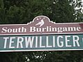
A view of SW Terwilliger Boulevard in South Burlingame.

