South Middleborough Historic District facts for kids
Quick facts for kids |
|
|
South Middleborough Historic District
|
|

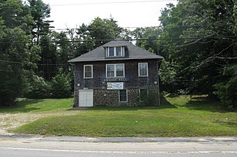
The South Middleborough Grange Hall
|
|
| Lua error in Module:Location_map at line 420: attempt to index field 'wikibase' (a nil value). | |
| Location | Locust, Spruce, and Wareham Sts., Middleborough, Massachusetts |
|---|---|
| Area | 88 acres (36 ha) |
| Built | 1768 |
| Architectural style | Colonial, Greek Revival, 51 |
| NRHP reference No. | 09000438 |
| Added to NRHP | June 19, 2009 |
The South Middleborough Historic District is a special area in South Middleborough, Massachusetts. It includes the old village center. This village is about 6.5 miles (10.5 km) south of the main town. It is located where Wareham Street and Locust Street meet.
For many years, Wareham Street (also known as Massachusetts Route 28) was the main road to Cape Cod. But in 1966, Massachusetts Route 24 was built. This new highway goes around the village. Because of this, the village center has not changed much since then.
What is the South Middleborough Historic District?
This historic district covers about 88 acres (36 ha) of land. It has 75 important buildings and places. Most of these buildings were built between the late 1700s and about 1930.
The village started to grow in the late 1700s. It became a local center for community and business. A church was built, and a cemetery was created. This church is no longer there. The 1841 Greek Revival Methodist church now stands in its place.
How Did the Village Grow Over Time?
By the early 1800s, many houses had been built in the area. In 1848, the railroad arrived. This helped the village grow even more. Stores like the South Middleborough Store (built around 1890) opened. The lumber industry also became important.
In the 1920s, more people started using cars. This meant more traffic on Wareham Road. The village grew to serve travelers passing through. However, when Route 24 was built, less traffic came through the village. This caused the village to face economic challenges.

