South Moreton Castle facts for kids
Quick facts for kids South Moreton Castle |
|
|---|---|
| South Moreton, Oxfordshire, England | |
| Coordinates | 51°35′18″N 1°11′48″W / 51.5884°N 1.1966°W |
| Type | Motte and bailey |
| Site information | |
| Condition | Earthworks remain |
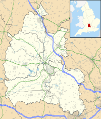
South Moreton Castle was a type of castle built around the 11th century. You can find its remains in the village of South Moreton, which is in Oxfordshire, England. Sometimes, the name "South Moreton Castle" can also refer to another castle nearby. This second castle was likely built in the 12th century.
Contents
What is South Moreton Castle?
South Moreton Castle was designed as a motte and bailey castle. This means it had a large earth mound, called a motte, and a fenced area, called a bailey. It was built by the Normans in the 11th century.
The Main Castle's Features
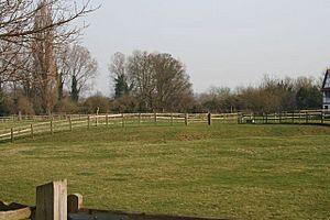
This castle sits near Mill Brook in South Moreton village. The motte, or mound, is about 50 meters (164 feet) wide and 4 meters (13 feet) high. A ditch, about 15 meters (49 feet) wide, goes around the motte. This ditch might have been filled with water from the brook.
The motte was damaged a long time ago, in the late Victorian period. There was also a long earth bank, about 50 meters (164 feet) long, that stretched from the castle. This bank might have been destroyed around the same time.
A Special Place in History
Local stories say that some people who died in the English Civil War in the 17th century were buried on the motte. Today, South Moreton Castle is a scheduled monument. This means it's a very important historical site that is protected by law.
The Second Castle: A Siege Story
Just north of the main South Moreton Castle, there's another old fortification. This second castle probably dates back to a difficult time in England called the Anarchy. This was a civil war in the 12th century.
What Was the Second Castle For?
This second castle has a large ditch around it, measuring about 85 meters (279 feet) by 130 meters (427 feet). Experts think it was a siege castle. A siege castle was built to surround and attack another castle. In this case, it might have been used to trap the forces of Empress Matilda at nearby Wallingford Castle.
However, some people have a different idea. They think this large ditch might have been part of a nearby manor house. They believe the "siege castle" mentioned in the 1140s was actually the first castle, the one overlooking Mill Brook.
 | Kyle Baker |
 | Joseph Yoakum |
 | Laura Wheeler Waring |
 | Henry Ossawa Tanner |


