South Raub, Indiana facts for kids
Quick facts for kids
South Raub, Indiana
|
|
|---|---|

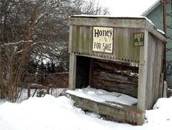
Snow covers a derelict stand in South Raub
|
|

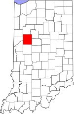
Tippecanoe County's location in Indiana
|
|
| Country | United States |
| State | Indiana |
| County | Tippecanoe |
| Townships | Randolph, Wea |
| Elevation | 712 ft (217 m) |
| Time zone | UTC-5 (Eastern (EST)) |
| • Summer (DST) | UTC-4 (EDT) |
| ZIP code |
47909
|
| Area code(s) | 765 |
| GNIS feature ID | 443844 |
South Raub is a small place in Indiana that isn't officially a town or city. It's known as an unincorporated community. You can find it in Tippecanoe County, right where two areas called Randolph and Wea Townships meet.
A Look Back: South Raub's History
South Raub once had its own post office. It first opened in 1878. The post office served the community for many years. However, it eventually closed down in 1926.
Exploring South Raub's Geography
South Raub is located along County Road 800 South. This road is about half a mile west of a main highway. That highway is US Route 231 and State Road 43. A train track also runs through the community. This CSX rail line connects the cities of Lafayette and Crawfordsville. South Raub is about 711 feet above sea level.
A small stream called Wea Creek flows nearby. It is less than half a mile from South Raub. The creek runs to the north and west of the community.
Lapham Feed and Grain: A Local Business
Lapham Feed and Grain, Inc. was an important business in South Raub. Richard and Eula Lapham started it in 1956. They had moved to South Raub from Decatur, Illinois. Many local farmers called it the "South Raub Elevator."
Something big happened there on November 24, 1959. A coal train with 20 cars crashed. The accident badly damaged the west side of the elevator. Luckily, no one was hurt in the crash. The elevator was later rebuilt.


