St. Mary's, Alaska facts for kids
Quick facts for kids
Saint Mary's
Negeqliq (Central Yupik)
|
|
|---|---|
| Country | United States |
| State | Alaska |
| Census Area | Kusilvak Census Area |
| Incorporated | August 2, 1967 |
| Area | |
| • Total | 51.57 sq mi (133.56 km2) |
| • Land | 44.60 sq mi (115.53 km2) |
| • Water | 6.96 sq mi (18.03 km2) |
| Population
(2020)
|
|
| • Total | 599 |
| • Density | 13.43/sq mi (5.19/km2) |
| ZIP code |
99658
|
| Area code | 907 |
| FIPS code | 02-66140 |
St. Mary's (which is called Negeqliq in the Yup'ik language) is a small city in Alaska, United States. It is located in the Kusilvak Census Area. In 1980, a nearby village called Andreafsky (also known as Clear River) became part of St. Mary's.
According to the 2020 census, about 599 people live there. This number has grown from 507 people in 2010.
There are two official Native Alaskan tribes recognized by the government in St. Mary's. These are the Algaaciq Native Village and the Yuupiit of Andreafsky.
Location and Weather in St. Mary's
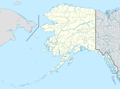
St. Mary's is located at 62°2′43″N 163°13′7″W / 62.04528°N 163.21861°W. This means it is in a northern part of the world.
The city covers a total area of about 50.2 square miles (130 square kilometers). Most of this area, about 44.0 square miles (114 square kilometers), is land. The rest, about 6.3 square miles (16 square kilometers), is water.
The weather in St. Mary's can vary a lot. Here is a summary of the climate:
| Climate data for St. Mary's (1961–1990 normals, extremes 1967–1983) | |||||||||||||
|---|---|---|---|---|---|---|---|---|---|---|---|---|---|
| Month | Jan | Feb | Mar | Apr | May | Jun | Jul | Aug | Sep | Oct | Nov | Dec | Year |
| Record high °F (°C) | 46 (8) |
41 (5) |
43 (6) |
60 (16) |
78 (26) |
80 (27) |
83 (28) |
95 (35) |
73 (23) |
57 (14) |
43 (6) |
41 (5) |
95 (35) |
| Mean maximum °F (°C) | 34.8 (1.6) |
34.3 (1.3) |
38.4 (3.6) |
47.7 (8.7) |
65.1 (18.4) |
73.5 (23.1) |
76.4 (24.7) |
73.9 (23.3) |
65.0 (18.3) |
49.4 (9.7) |
38.1 (3.4) |
35.0 (1.7) |
79.1 (26.2) |
| Mean daily maximum °F (°C) | 14.2 (−9.9) |
15.7 (−9.1) |
23.5 (−4.7) |
33.3 (0.7) |
50.4 (10.2) |
59.9 (15.5) |
63.8 (17.7) |
61.7 (16.5) |
53.0 (11.7) |
36.8 (2.7) |
21.9 (−5.6) |
14.5 (−9.7) |
37.5 (3.1) |
| Daily mean °F (°C) | 9.0 (−12.8) |
6.6 (−14.1) |
15.2 (−9.3) |
24.3 (−4.3) |
42.2 (5.7) |
50.8 (10.4) |
55.2 (12.9) |
53.8 (12.1) |
44.7 (7.1) |
30.2 (−1.0) |
16.9 (−8.4) |
6.6 (−14.1) |
29.6 (−1.3) |
| Mean daily minimum °F (°C) | 1.6 (−16.9) |
0.3 (−17.6) |
6.1 (−14.4) |
17.6 (−8.0) |
32.8 (0.4) |
41.7 (5.4) |
46.5 (8.1) |
44.6 (7.0) |
36.0 (2.2) |
23.6 (−4.7) |
9.6 (−12.4) |
0.5 (−17.5) |
21.8 (−5.7) |
| Mean minimum °F (°C) | −25.2 (−31.8) |
−29.7 (−34.3) |
−21.6 (−29.8) |
−7.9 (−22.2) |
19.6 (−6.9) |
31.8 (−0.1) |
38.0 (3.3) |
34.1 (1.2) |
23.4 (−4.8) |
2.4 (−16.4) |
−11.1 (−23.9) |
−27.1 (−32.8) |
−37.7 (−38.7) |
| Record low °F (°C) | −44 (−42) |
−42 (−41) |
−40 (−40) |
−23 (−31) |
2 (−17) |
26 (−3) |
30 (−1) |
29 (−2) |
15 (−9) |
−13 (−25) |
−29 (−34) |
−41 (−41) |
−44 (−42) |
| Average precipitation inches (mm) | 1.04 (26) |
0.71 (18) |
0.74 (19) |
0.76 (19) |
1.03 (26) |
2.02 (51) |
2.62 (67) |
3.09 (78) |
2.34 (59) |
1.70 (43) |
1.63 (41) |
1.45 (37) |
19.13 (486) |
| Average snowfall inches (cm) | 10.2 (26) |
4.8 (12) |
8.0 (20) |
5.8 (15) |
1.2 (3.0) |
0.9 (2.3) |
0.0 (0.0) |
0.0 (0.0) |
0.7 (1.8) |
5.8 (15) |
15.0 (38) |
15.4 (39) |
44.7 (114) |
| Average precipitation days (≥ 0.01 inch) | 9.4 | 6.5 | 6.8 | 7.3 | 8.6 | 13.0 | 14.9 | 16.9 | 14.8 | 13.4 | 11.6 | 10.9 | 134.1 |
| Average snowy days (≥ 0.1 inch) | 9.4 | 5.9 | 7.6 | 7.8 | 1.9 | 0.9 | 0.0 | 0.0 | 0.6 | 5.6 | 11.4 | 9.9 | 61.0 |
| Source 1: WRCC | |||||||||||||
| Source 2: XMACIS (snowfall) | |||||||||||||
Population and People of St. Mary's
| Historical population | |||
|---|---|---|---|
| Census | Pop. | %± | |
| 1960 | 225 | — | |
| 1970 | 384 | 70.7% | |
| 1980 | 382 | −0.5% | |
| 1990 | 441 | 15.4% | |
| 2000 | 500 | 13.4% | |
| 2010 | 507 | 1.4% | |
| 2020 | 599 | 18.1% | |
| U.S. Decennial Census | |||
St. Mary's first appeared on the U.S. Census in 1960. It was officially made a city in 1967.
In 2000, there were 500 people living in St. Mary's. These people lived in 137 households, and 90 of these were families. The city had about 11.4 people per square mile.
Most of the people in St. Mary's are American Indian/Alaska Native, making up 87.2% of the population. About 11.2% of the people are White. A small number, 0.4%, are Hispanic or Latino.
Many households (45.3%) had children under 18 living with them. About 40.9% were married couples. The average household had about 3.58 people.
The population of St. Mary's is quite young. In 2000:
- 39.6% of the people were under 18 years old.
- 8.6% were between 18 and 24 years old.
- 30.4% were between 25 and 44 years old.
- 15.0% were between 45 and 64 years old.
- 6.4% were 65 years or older.
The average age of people in St. Mary's was 26 years. For every 100 females, there were about 122 males.
The average income for a household in the city was $39,375 per year. For families, the average income was $31,875. The average income per person in the city was $15,837. About 20.4% of all people in St. Mary's lived below the poverty line. This included 28.2% of those under 18 and 10.3% of those 65 or older.
See also
 In Spanish: St. Mary's (Alaska) para niños
 | James Van Der Zee |
 | Alma Thomas |
 | Ellis Wilson |
 | Margaret Taylor-Burroughs |


