Stanney Brook facts for kids
Quick facts for kids Stanney Brook |
|
|---|---|
 |
|
| Country | England |
| Physical characteristics | |
| Main source | Burnedge, Shaw and Crompton, Greater Manchester, England |
| River mouth | River Roch, Newbold Brow, Rochdale, Greater Manchester, England 53°37′14.79″N 2°8′25.86″W / 53.6207750°N 2.1405167°W |
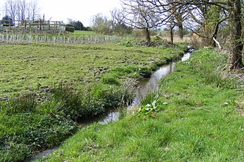
Stanney Brook is a small waterway in Greater Manchester, England. It starts in the Burnedge area of Shaw and Crompton. From there, it flows through Milnrow and into Rochdale. Finally, it joins the River Roch near Newbold Brow.
This brook is special because it doesn't flow through the middle of Milnrow or Newhey villages. It also goes straight into the River Roch, unlike other local streams that first join the River Beal. Its name comes from an old word, "stanner," which means a ridge of stones.
The Stanney Brook drops about 100 meters (330 feet) over a distance of just over 5.5 kilometers (3.5 miles). It is usually only about 60 centimeters (2 feet) wide. It rarely gets wider than 90 centimeters (3 feet).
Contents
Stanney Brook: A Little River's Journey
Stanney Brook is a fascinating example of how small waterways connect to larger river systems. It plays a part in the local environment of Greater Manchester.
Where Does Stanney Brook Start?
The journey of Stanney Brook begins in the Burnedge area. This area is part of Shaw and Crompton, a town in Greater Manchester. The exact starting point can even change a little. This depends on how wet the surrounding moorland is.
How Does Stanney Brook Flow?
After starting in Burnedge, the brook makes its way towards Rochdale. It flows through Milnrow first. Along its path, the brook goes underground four times. This happens when it passes under roads or buildings. When a river goes underground like this, it is called being "culverted."
Stanney Brook's Path North of the M62
North of the M62 motorway, the brook flows down 17 concrete steps. It also makes a sharp 100-degree turn. This part is under Sir Isaac Newton Way, in the Kingsway Business Park. It then feeds a small lake south of Stanney Brook Park. The brook forms the eastern edge of this park.
Next, it crosses private land within the Business Park. Here, it goes under Michael Faraday Avenue through a special bridge. This bridge has three arches: one for the brook and two for other drains that join the brook. Then, it flows under the Manchester-Rochdale Metrolink line. You can often see the brook's winding path from a Metrolink tram. You might even spot the three-arch bridge.
The brook then disappears into a long culvert. It goes under the Rochdale Canal, Kingsway Retail Park, and a busy road junction. It comes out again to form the northern edge of Jubilee Park. This is a narrow park managed by the Forestry Commission.
Joining the River Roch
The brook continues past Belfield Lodge and into a deep valley. This is north of Belfield Lane, Rochdale. From there, it is culverted again, going under what used to be a factory. It reappears near Croxton Avenue, Newbold Brow. Finally, it flows through Roch Wood to join the River Roch. This meeting point is next to a footbridge from Gowers Street, Hamer, Rochdale.
| Next confluence upstream | River Roch | Next confluence downstream |
| River Beal | Stanney Brook | Hey Brook |
 | James B. Knighten |
 | Azellia White |
 | Willa Brown |

