Shaw and Crompton facts for kids
Quick facts for kids Shaw and Crompton |
|
|---|---|
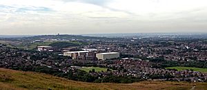 A view of Shaw and Crompton from Crompton Moor |
|
| Area | 4.5 sq mi (12 km2) |
| Population | 21,065 (2011 census) |
| • Density | 4,681/sq mi (1,807/km2) |
| OS grid reference | SD938090 |
| • London | 166 mi (267 km) SSE |
| Civil parish |
|
| Metropolitan borough | |
| Metropolitan county | |
| Region | |
| Country | England |
| Sovereign state | United Kingdom |
| Post town | Oldham |
| Postcode district | OL2 |
| Dialling code | 01706 |
| Police | Greater Manchester |
| Fire | Greater Manchester |
| Ambulance | North West |
| EU Parliament | North West England |
| UK Parliament |
|
Shaw and Crompton is a town in Greater Manchester, England. It sits by the River Beal near the South Pennines hills. It's about 2 miles (3.2 km) north of Oldham and 9 miles (14 km) northeast of Manchester. The biggest part of the town is called Shaw.
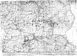
Long ago, this area was part of Lancashire. People lived here even in ancient times. In the Middle Ages, Crompton was a small area with farms and woodlands. There wasn't a strong local lord, so people had more freedom. Farming was the main job, and many families also wove wool at home.
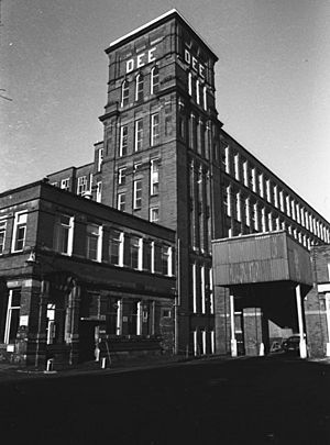
Later, during the Industrial Revolution, factories started making textiles. This changed the area quickly. Many cotton mills were built in the mid-1800s. By the late 1800s, Shaw and Crompton had 48 cotton mills. Some were the biggest in the UK. After World War I, the town became very rich from the textile industry. It was even said to have more millionaires per person than any other town in the world! But by the mid-1900s, the textile industry declined. The last mill closed in 1989.
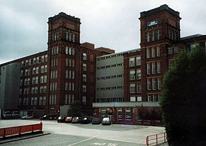
Today, Shaw and Crompton covers about 4.5 square miles (11.7 km2). It's mostly a suburban area with a population of 21,065 (as of 2011). You can still see its industrial past in the three remaining cotton mills. These are now used by large delivery companies, like Yodel.
Contents
- History of Shaw and Crompton
- How Shaw and Crompton is Run
- Where is Shaw and Crompton?
- People of Shaw and Crompton
- What Shaw and Crompton Makes and Does
- Famous Places in Shaw and Crompton
- Getting Around Shaw and Crompton
- Schools in Shaw and Crompton
- Places of Worship
- Fun Things to Do and Places to Go
- Public Services
- Famous People from Shaw and Crompton
- See also
History of Shaw and Crompton
What's in a Name?
The name Shaw comes from an old English word, sceaga, meaning "wood". The name Crompton also comes from old English words. Crom or crumb means "bent" or "crooked", and ton means "hamlet or village". One local historian said this name perfectly describes the area's uneven hills. Another idea is that Crompton means "river-bend settlement", because it's on a bend of the River Beal.
Having two names, Shaw and Crompton, makes the town special. People used to argue about which name was better! Today, most people just say Shaw.
Shaw was first a small village within the larger area of Crompton. It grew because a small chapel was built there in the 1500s. Also, a main road and a post office were set up in Shaw. This made Shaw more important than other villages like Whitfield. In 1835, a separate church area was created for the township. It was named Shaw because the church was on Shaw Moor. Eventually, the names combined to become Shaw and Crompton.
Early Days
People have lived in this area for a very long time. An ancient axe from the Bronze Age was found on Crompton Moor. It's thought that ancient Britons lived here. The Brigantes people might have given the River Beal its name. There's also an old path, possibly from Roman times, that leads to a Roman fort nearby.
Around 616 AD, an Anglo-Saxon king named Æthelfrith came through this area. After his army, Anglo-Saxon settlers arrived. Places ending in ton, like Crompton, might have been founded by these settlers in the 600s.
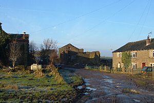
After the Norman conquest of England, Crompton was part of a big estate. The name Crompton was first written down in legal papers from the early 1200s. These papers show that land was given to a monastery called Cockersand Abbey. The Knights Hospitaller, a religious group that helped sick pilgrims, also owned land here.
In the High Middle Ages, Crompton was a quiet place with woods, farms, and a few small communities. There wasn't a strong lord ruling the area. This meant people had more freedom. Families from nearby areas moved here.
Later, in the Late Middle Ages, the Buckley and Crompton families owned the most land. The Crompton family has a long history, going back to the 1200s. They even had a large house called Crompton Hall. The original hall was taken down around 1848. A new Crompton Hall was built, but it was also taken down in 1950 to build new homes.
People from Crompton were known for being "hardy and hardworking". This might be because they had to rely on themselves. There was a small chapel in Shaw from the 1500s. But people in Crompton had to pay money to the main church in Oldham. They often refused to pay! In 1826, when Oldham Church was being rebuilt, not one person in Crompton voted for it.
Mills and the Industrial Revolution
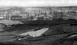
People started making textiles in Crompton as early as 1474. Back then, people raised sheep for wool. They would weave woollen cloth at home to earn extra money. They sold their cloth to traders who took it to markets in Manchester and Rochdale. Even though it was a remote area, some people became quite wealthy from this home weaving.
In the mid-1700s, cotton became more popular. Crompton started making cotton cloth, just like Oldham and Manchester. A law even made people bury the dead in woollen clothes to help the wool trade!
Later in the 1700s, machines for spinning cotton got much better. Larger buildings were needed for these new machines. By 1789, ten mills had been built. This led to a big change in the area. More people moved away from farming to work in the new factories. The population grew from 872 in 1714 to 3,500 in 1801. Many people came from Yorkshire and Lancashire looking for mill jobs.
In the early 1800s, power looms were introduced. This meant machines did most of the weaving. Hand weavers struggled to compete. In 1826, some angry workers called Luddites smashed 24 power looms at a mill in High Crompton. They were protesting against their hard lives.
Crompton's damp weather was perfect for spinning cotton. In the 1860s, land for factories became scarce in Oldham. So, many new mills were built in Shaw and Crompton. The town became a major "mill town". The old villages and hamlets grew together around these factories. A railway station opened in 1863. This made it easier to transport cotton and finished goods. Shaw and Crompton became part of a huge cotton-spinning area that made 13% of the world's cotton!
Between 1870 and 1900, 12 more cotton mills were built. After World War I, people invested a lot of money in cotton companies. Many mills were sold for huge amounts of money. Because of this, Shaw and Crompton was nicknamed "The Golden City". It was said to have more millionaires per person than any other town in the world! In 1920, there were 36 cotton mills in the town.
During the American Civil War (1861–1865), cotton supplies from the United States were cut off. This caused hard times. The Great Depression and the World Wars also caused economic problems. By the mid-1900s, cheaper cotton from other countries led to a decline. By the early 1980s, only four mills were still working. The very last cotton was spun in Shaw and Crompton in 1989. Out of 48 cotton mills, only three are still standing today. They are now used as distribution centers.
Modern Times
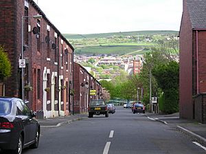
After the mills closed, Shaw and Crompton kept growing. Many new homes were built. A third of the homes are still old Victorian or Edwardian terraced houses, built for mill workers. The town is seen as a good place to live. Areas like Buckstones and Rushcroft have newer, more expensive homes.
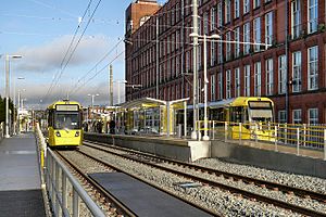
Shaw and Crompton has been used for filming movies and TV shows. These include The Parole Officer and Scott & Bailey. The town was in the news in 2010, 2011, and 2012 for some serious events. In 2012, the Shaw and Crompton Metrolink station opened. This connected the town to Manchester's light-rail system.
For a long time, Shaw and Crompton's economy was all about making textiles. Until the 1990s, the lightbulb company Osram had a factory here. It was a big employer. The bakery company Warburtons also had a large bakery in Shaw and Crompton until 2012.
Until the early 2020s, Shop Direct Group had a huge distribution center here. It was one of the UK's largest warehouses. It employed almost 1,000 people. This made it the biggest private employer in the area.
How Shaw and Crompton is Run
In 1212, Crompton was part of an estate owned by King John. Local men helped keep law and order. Later, in 1863, a Local Board of Health was set up. This group made sure the town was clean and healthy. In 1894, this became the Crompton Urban District. The council worked from Shaw/Crompton Town Hall.
In 1974, Shaw and Crompton became part of the Metropolitan Borough of Oldham. This is a larger local government area. In 1987, a local council was formed for Shaw and Crompton. It's called a civil parish council. It has some power over local issues, like planning. The council has 14 elected members. There's also a Community Forum where local people can share their ideas.
Shaw and Crompton doesn't have a mayor. Instead, it has a Chair of Council who does ceremonial duties. The town also has a town crier! This is a special person who makes public announcements. Shaw and Crompton is one of the few places in England that still does the old custom of Beating the bounds. This is when people walk the town's boundaries. It happens every seven years.
For national government, Shaw and Crompton is part of the Oldham East and Saddleworth area. The local Member of Parliament (MP) is Debbie Abrahams from the Labour Party. Famous people like Winston Churchill were MPs for this area in the past. Churchill once stayed at Crompton Hall and wrote about how peaceful it was.
Where is Shaw and Crompton?

Shaw and Crompton is located at 53.5777° N, 2.0928° W. It's on the eastern edge of the old Lancashire border. Saddleworth and the Pennines hills are to the east. Rochdale is to the northwest, and Oldham is to the south. Royton is about 1.2 miles (1.9 km) to the west-southwest.
There are no major highways in Shaw and Crompton. But a light-rail line cuts through the town from north to south. The town has a post office and its postcode starts with OL. Shaw and Crompton is part of the larger Greater Manchester Urban Area. Manchester city centre is about 8.7 miles (14 km) southwest.
The town is in the valley of the River Beal. This river flows north through the town. To the east, the land rises to Crompton Moor, which is 1,283 feet (391 m) high. To the west, the land is lower, around 699 feet (213 m) at High Crompton. The River Irk starts on Shaw and Crompton's western border. The area has carboniferous coal measures underground. The soil is generally not very fertile, especially on the moors. Shaw and Crompton gets a lot of rain, between 51 and 67 inches (1,300 to 1,700 mm) a year. This is more than the UK average.
 |
Rochdale | Newhey | Denshaw |  |
| Thornham | Delph | |||
| Royton | Oldham | Sholver |
Shaw and Crompton has a mix of areas. There are residential homes, a High Street with shops, suburbs, and some rural areas. Most of the land is used for homes. Older, smaller homes are found in the center, west, and south. Newer, larger homes are in the east and north.
The town is divided into two political areas: "Shaw" (east) and "Crompton" (west).
People of Shaw and Crompton
| Shaw and Crompton Compared | |||
|---|---|---|---|
| UK Census 2001 | Shaw and Crompton | Oldham (Met. District) | England |
| Total population | 21,721 | 217,273 | 49,138,831 |
| Foreign born | 3.2% | 8.2% | 9.2% |
| White | 96% | 86% | 91% |
| Asian | 2.0% | 12% | 4.6% |
| Black | 0.3% | 0.6% | 2.3% |
| Christian | 84% | 73% | 72% |
| Muslim | 1.7% | 11% | 3.1% |
| Hindu | 0.2% | 0.1% | 1.1% |
| No religion | 6.8% | 8.9% | 15% |
| Over 65 years old | 15% | 14% | 16% |
| Unemployed | 2.4% | 3.7% | 3.3% |
In 2001, Shaw and Crompton had 21,721 people living there. This means about 4,692 people lived in each square mile (1,811 per km2). The average age was 39. About 3% of the people were from black and minority ethnic backgrounds. Most people were white.
Most households were married couples (41.7%). Some were couples living together (9.2%), and some were single-parent families (9.7%). Forty percent of homes had one person living alone.
Most people (96.8%) were born in the United Kingdom. Most (84%) were Christian, and 1.7% were Muslim. About 6.8% said they had no religion.
Most people aged 16–74 were working full-time (45%). About 15% of people aged 16–74 had a higher education degree. This was a bit lower than the national average of 20%.
Here's how the population has grown since 1901:
| Year | 1901 | 1911 | 1921 | 1931 | 1939 | 1951 | 1961 | 1971 | 1991 | 2001 | 2011 | 2021 | ||
|---|---|---|---|---|---|---|---|---|---|---|---|---|---|---|
| Population | 13,427 | 14,750 | 14,917 | 14,764 | 12,796 | 12,559 | 12,708 | 17,026 | 21,093 | 21,721 | 21,065 | 20,374 | ||
| Source:A Vision of Britain through Time | ||||||||||||||
What Shaw and Crompton Makes and Does
Shaw and Crompton is a good place for distribution companies. This is because it has good transport links and large, empty mill buildings. It's also located between big cities like Manchester and Rochdale. Companies like N Brown Group and Toy Options have distribution centers here.
Trent Mill Industrial Estate has many small industrial businesses. Part of it was damaged by a fire in 2007.
In 2007, a large Asda supermarket opened where the old Dawn Mill used to be. This supermarket cost £20 million to build. It was the first Asda store in the UK to use eco-friendly building methods. Wal-Mart, Asda's parent company, plans to use these methods for all new Asda stores.
Famous Places in Shaw and Crompton
War Memorials
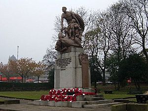
The main Crompton War Memorial is on the High Street. It's a large bronze statue on a granite base. It lists the names of 346 people from Shaw and Crompton who died in the First World War. Names from the Second World War were added later. The statue was designed in 1919 and unveiled in 1923. It cost a lot of money to build.
The memorial says: In memory of the men of Crompton who fought and gave their lives to free mankind from the oppression and brutal tyranny of war. 1914–1919.
The statue shows a man protecting children from a beast, which stands for war. Inside the memorial, there's a time capsule. It holds coins, a newspaper, and samples of cotton made in the area.
A smaller war memorial is in Jubilee Gardens. It honors soldiers who died in the Second Boer War. It lists eight men who were killed or died from wounds or disease.
Shaw and Crompton Beacon
In 1995, a landmark called the Shaw and Crompton Beacon was put up in Jubilee Gardens. This was to celebrate 50 years since the end of the Second World War.
The plaque under the beacon says: The Shaw and Crompton beacon erected by the Parish Council in 1995 to commemorate the fiftieth anniversary of the ending of World War Two this plaque was presented by members of the British Legion
Crompton Moor
Crompton Moor is a large open space, about 160 acres (0.65 km2). It reaches a height of 1,282 feet (391 m). It's managed by Oldham Countryside Service. Since 2003, it's been a special area for biological importance.
Brushes Clough and Pingot are old quarries on Crompton Moor. In the 1970s, digging stopped. The land was restored, and many pine trees were planted. Now, people use the area for hiking and mountain biking. Brushes Clough Reservoir was built in the 1800s using stone from the quarry.
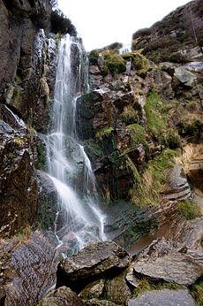
Since the 1960s, an unnamed waterfall has flowed from Crompton Moor into the old Pingot Quarry. It forms the Old Brook, which flows into the River Beal.
Big Lamp
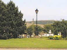
The Big Lamp is a well-known local landmark. The original lamp was a 20-foot (6.1 m) tall gas-powered street lamp. It stood at a main crossroads. It was taken down in 1925 when electric lights were installed. In the 1970s, the crossroads was changed into a large roundabout. A smaller copy of the Big Lamp, about 6 feet (1.8 m) tall and electric, was put in the center.
Getting Around Shaw and Crompton
Public transport in Shaw and Crompton is managed by Transport for Greater Manchester. Shaw and Crompton used to have a railway line and station. It opened in 1863 for moving goods, and later for passengers. Shaw & Crompton railway station closed in 2009. It was changed to be part of the Metrolink light-rail system. The Shaw & Crompton tram stop opened on December 16, 2012.
In the past, electric trams ran in the town. The first tram line opened in 1904. The tram lines were replaced by buses in the 1930s.
Today, bus companies like First Greater Manchester and Rosso run many bus services. These buses go to Oldham, Rochdale, Manchester, and other nearby towns. There are also local "Shaw Circular" routes. Shaw and Crompton is located south of junction 21 of the M62 motorway.
Schools in Shaw and Crompton
There were private schools in homes a long time ago. The first public school in Crompton opened in 1791. In 1838, the Shaw National School was built. More church schools followed.
Today, Shaw and Crompton has many schools, including some with religious connections. All the schools in the town have good test results. Crompton House CE School is a secondary school for ages 11-16. It also has a college section for 16-18 year olds.
| School | Type/Status | Ofsted | Website |
|---|---|---|---|
| Beal Vale Primary School | Primary school | 105672 | website |
| Buckstones Primary School | Primary school | 105671 | website |
| Crompton House Church of England Academy | Secondary school | 105740 | website |
| Crompton Primary School | Primary school | 133286 | website |
| St George's CofE School | Primary school | 105717 | website |
| St James CofE School | Primary school | 105710 | website |
| Farrowdale House | Independent school | 105747 | website |
| Rushcroft Primary School | Primary school | 105659 | website |
| St Joseph's R.C. Primary | Primary school | 105719 | website |
| St Mary's CofE Primary School | Primary school | 105711 | website |
Places of Worship
Crompton was originally part of a larger church area called Prestwich-cum-Oldham. In 1541, it became part of the Diocese of Chester. Then in 1847, the Diocese of Manchester was created.
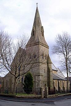
No one knows exactly when the first church was built in Crompton. But Shaw Chapel definitely existed in the early 1500s. It was known as St Patrick's Chapel-on-the-Moor. It was rebuilt in 1739, 1798, and again in 1870. Now it's called the Church of Holy Trinity.
Shaw and Crompton has three Church of England church areas. There are also many other Christian churches, like Methodist and Roman Catholic churches.
Here are some of the churches in Shaw and Crompton:
| Church | Type of Church | Built | Website |
|---|---|---|---|
| East Crompton, St James | Church of England |
|
www.ecsj.org.uk |
| East Crompton, St Saviours Crompton Fold | Church of England |
|
www.ecsj.org.uk |
| Hope Church | Christian Non-denominational |
|
www.hopechurchshaw.org.uk |
| Shaw, Holy Trinity | Church of England |
|
www.holytrinityshaw.co.uk |
| St Mary's High Crompton | Church of England |
|
http://www.holytrinityshaw.co.uk/ |
| Shore Edge Methodist | Methodist |
|
https://www.shawroytonmethodist.org.uk/churches/circuit-churches/shore-edge.html |
| St Andrew's Methodist | Methodist |
|
https://www.shawroytonmethodist.org.uk/churches/circuit-churches/st-andrews.html |
| St Paul's Shaw Methodist | Methodist |
|
www.stpaulsshaw.org.uk |
| Shaw United Reformed Church | Non-conformist |
|
Shaw & Heyside United Reformed Church |
| St Joseph Roman Catholic Church | Roman Catholic |
|
https://www.st-josephs.oldham.sch.uk/church |
| Salvation Army Church | Salvation Army |
|
https://www.salvationarmy.org.uk/ |
Most of these churches take part in Shaw's yearly Whit Walks. This is when church groups, choirs, and bands parade through the streets. Then they all come together for one big service. There is also a small mosque in the town center.
Fun Things to Do and Places to Go
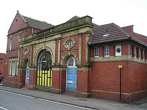
Shaw and Crompton has many public places and facilities. These include parks, sports areas, and playing fields. There are several pubs in the town center, like The Shay Wake and The Blue Bell.
Crompton Library is a modern library with over 36,000 items. You can borrow books, CDs, and DVDs. It also has computers with internet access. The library was built in the early 1990s because the old building was too small.
There are three main public parks. Dunwood Park has a playground, a bowling green, and wooded paths. It was given to the town in 1911 and reopened as a park in 1912. It was updated in 2012 with a £1 million grant. High Crompton Park has a tennis court, bowling green, playground, and gardens. Jubilee Gardens are in the town center, behind the War Memorial. Shaw and Crompton also has large areas for sports and community events.
Shaw Market is open every Thursday on Market Street. The street is closed to traffic for the market. The old market location, Westway, is now used for parking. It's also used for fun fairs and events. Crompton Pool was a swimming pool built in 1899. It closed in 2014 and was taken down in 2016. Crompton Cricket Club is on Glebe Street.
Playhouse 2 is a theater with 156 seats in the town center. It used to be a cinema. An amateur theater group, the Crompton Stage Society, has performed there since 1966.
Public Services
Police services in Shaw and Crompton are provided by the Greater Manchester Police. The main police station for the area is in central Oldham. Public transport is managed by Transport for Greater Manchester. Fire and rescue services are provided by the Greater Manchester Fire and Rescue Service.
There are no hospitals in Shaw and Crompton. The closest ones are in Oldham and Rochdale. But local health care is available at Crompton Health Centre, which is an NHS clinic. The North West Ambulance Service provides emergency transport.
Waste management is handled by the local council. Trash is sent to a landfill nearby. United Utilities provides electricity and manages drinking water and waste water. Water comes from local reservoirs.
Famous People from Shaw and Crompton
People from Shaw and Crompton are sometimes called Gawbies or Cromptonians.
- Philip Gilbert Hamerton, a famous artist and art critic, was born here in 1834.
- Actress Shobna Gulati lives here.
- Former football player and manager Andy Ritchie lives here.
- Kevin O'Toole, who started the dance group N-Trance, is from here.
- Nicola White, who won a gold medal in field hockey at the 2016 Summer Olympics, was born here.
- Comedians Tommy Cannon and Bobby Ball live nearby.
- Rugby player Marc Sneyd grew up here.
See also
 In Spanish: Shaw y Crompton para niños
 | James B. Knighten |
 | Azellia White |
 | Willa Brown |


