
West Branch Township, Missaukee County, Michigan facts for kids
Quick facts for kids
West Branch Township, Michigan
|
|
|---|---|
,_MI.jpg)
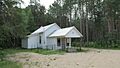
West Branch Township Hall
|
|
,_MI_location.png)
Location within Missaukee County
|
|

West Branch Township, Missaukee County, Michigan
Location in Michigan

West Branch Township, Missaukee County, Michigan
Location in the United States
|
|
| Country | United States |
| State | Michigan |
| County | Missaukee |
| Area | |
| • Total | 35.63 sq mi (92.3 km2) |
| • Land | 35.55 sq mi (92.1 km2) |
| • Water | 0.08 sq mi (0.2 km2) |
| Elevation | 1,188 ft (362 m) |
| Population
(2020)
|
|
| • Total | 452 |
| • Density | 12.7/sq mi (4.9/km2) |
| Time zone | UTC-5 (Eastern (EST)) |
| • Summer (DST) | UTC-4 (EDT) |
| ZIP Codes | |
| Area code(s) | 231 |
| FIPS code | 26-113-85560 |
| GNIS feature ID | 1627247 |
West Branch Township is a special kind of local government area called a civil township. It is located in Missaukee County, in the state of Michigan, USA. In 2020, about 452 people lived here.
Contents
Communities in West Branch Township
West Branch Township is home to a few small communities. These places are not officially separate cities or towns, but they are important parts of the township's history.
Star City: A Historic Community
Star City is a small, unincorporated community within the township. It started around 1872. This community once had its own post office.
- The post office first opened on February 27, 1880, and was called "Roy."
- It changed its name to "Putnam" on June 6, 1883.
- Finally, it became "Star City" on February 13, 1885.
- The post office closed down on December 15, 1923.
Keelans Corner: A Small Settlement
Keelans Corner is another small community located in the township. It is found near the southern border, close to Aetna Township.
Missaukee: A Former Post Office Location
Missaukee was once the site of a rural post office. This post office was about 8 miles (13 km) northeast of Lake City. It operated from June 6, 1901, until June 15, 1921.
Geography of West Branch Township
West Branch Township is located in the middle of Missaukee County. The center of the township is about 12 miles (19 km) northeast of Lake City.
Land and Water Areas
The township covers a total area of about 35.63 square miles (92.28 square kilometers).
- Most of this area, about 35.55 square miles (92.07 square kilometers), is land.
- A small part, about 0.08 square miles (0.21 square kilometers), is water. This means about 0.23% of the township is water.
The West Branch of the Muskegon River
An important natural feature of the township is the West Branch of the Muskegon River. This river flows through the township from west to east.
Population Changes Over Time
The number of people living in West Branch Township has changed quite a bit over the years. Here's a look at the population from 1880 to 2020:
| Historical population | |||
|---|---|---|---|
| Census | Pop. | %± | |
| 1880 | 65 | — | |
| 1890 | 230 | 253.8% | |
| 1900 | 315 | 37.0% | |
| 1910 | 426 | 35.2% | |
| 1920 | 330 | −22.5% | |
| 1930 | 299 | −9.4% | |
| 1940 | 318 | 6.4% | |
| 1950 | 264 | −17.0% | |
| 1960 | 218 | −17.4% | |
| 1970 | 234 | 7.3% | |
| 1980 | 371 | 58.5% | |
| 1990 | 473 | 27.5% | |
| 2000 | 532 | 12.5% | |
| 2010 | 466 | −12.4% | |
| 2020 | 452 | −3.0% | |
| U.S. Decennial Census | |||
What the 2000 Census Showed
In the year 2000, the census counted 532 people living in the township.
- There were 182 households, which are groups of people living together.
- 137 of these households were families.
- On average, about 2.85 people lived in each household.
- The average family size was 3.23 people.
Age Groups in 2000
The population was spread out across different age groups:
- About 29.3% of the people were under 18 years old.
- About 7.3% were between 18 and 24 years old.
- About 27.3% were between 25 and 44 years old.
- About 22.6% were between 45 and 64 years old.
- About 13.5% were 65 years old or older.
- The average age of people in the township was 37 years.
Income in 2000
- The average income for a household was $36,161.
- For families, the average income was $41,042.
- About 4.5% of families and 12.0% of all people in the township lived below the poverty line. This included 7.4% of those under 18 and 12.3% of those 65 or older.
Images for kids
-
West Branch Township Hall
-

Location within Missaukee County
See also
 In Spanish: Municipio de West Branch (condado de Missaukee) para niños
