
State Line, Mississippi facts for kids
Quick facts for kids
State Line, Mississippi
|
||
|---|---|---|
|
||

Location of State Line, Mississippi
|
||

State Line, Mississippi
Location in the United States
|
||
| Country | United States | |
| State | Mississippi | |
| Counties | Greene, Wayne | |
| Area | ||
| • Total | 4.30 sq mi (11.13 km2) | |
| • Land | 4.26 sq mi (11.04 km2) | |
| • Water | 0.03 sq mi (0.09 km2) | |
| Elevation | 253 ft (77 m) | |
| Population
(2020)
|
||
| • Total | 452 | |
| • Density | 106.00/sq mi (40.93/km2) | |
| Time zone | UTC-6 (Central (CST)) | |
| • Summer (DST) | UTC-5 (CDT) | |
| ZIP code |
39362
|
|
| Area code(s) | 601 | |
| FIPS code | 28-70320 | |
| GNIS feature ID | 0678229 | |

State Line is a small town located in the state of Mississippi, United States. It's unique because it sits across two different counties: Greene and Wayne. In 2020, about 452 people lived there.
Contents
History of State Line
State Line got its start a long time ago. A post office was opened there in 1856. The town officially became a town in 1875.
State Line was an important stop on the Mobile and Ohio Railroad. This railroad was built through Mississippi in the 1850s. It helped connect towns and move goods across the region.
Where is State Line?
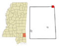
State Line is located at coordinates 31°26′16″N 88°28′34″W / 31.43778°N 88.47611°W. It's right on the border between Wayne County to the north and Greene County to the south. The town is almost equally split between these two counties.
About half of the town's residents live in Greene County and the other half in Wayne County. The town center is about 1.5 miles west of the border with Alabama.
Roads and Travel
Several important roads pass near or through State Line.
- U.S. Route 45 goes through the northeast part of town. It can take you northwest to Waynesboro, which is the county seat for Wayne County. It also goes southeast to Mobile, Alabama.
- Mississippi Highway 57 runs along the east side of State Line. This road leads south to Leakesville, the county seat for Greene County.
- Mississippi Highway 42 goes right through the middle of State Line. It's known as St. Peter Street in town and heads west towards Hattiesburg.
Size of the Town
The town of State Line covers a total area of about 4.30 square miles (11.13 square kilometers). Most of this area is land, with only a small part being water.
People of State Line
The population of State Line has changed over the years. Here's how it has grown and shrunk:
| Historical population | |||
|---|---|---|---|
| Census | Pop. | %± | |
| 1880 | 97 | — | |
| 1900 | 379 | — | |
| 1910 | 363 | −4.2% | |
| 1930 | 358 | — | |
| 1940 | 542 | 51.4% | |
| 1950 | 492 | −9.2% | |
| 1960 | 653 | 32.7% | |
| 1970 | 598 | −8.4% | |
| 1980 | 484 | −19.1% | |
| 1990 | 395 | −18.4% | |
| 2000 | 555 | 40.5% | |
| 2010 | 565 | 1.8% | |
| 2020 | 452 | −20.0% | |
| U.S. Decennial Census | |||
Who Lives in State Line?
The table below shows the different groups of people living in State Line as of 2020. "NH" means "Non-Hispanic."
| Race | Number | Percentage |
|---|---|---|
| White (NH) | 184 | 40.71% |
| Black or African American (NH) | 245 | 54.2% |
| Native American or Alaska Native (NH) | 3 | 0.66% |
| Asian (NH) | 1 | 0.22% |
| Some Other Race (NH) | 1 | 0.22% |
| Mixed/Multi-Racial (NH) | 11 | 2.43% |
| Hispanic or Latino | 7 | 1.55% |
| Total | 452 |
In 2020, there were 452 people living in State Line. These people lived in 250 households, and 176 of those were families.
In 2000, there were 555 people. The town was made up of about 42.70% White people and 56.94% African American people.
Education in State Line
Students in State Line attend different school districts depending on which county they live in.
- If you live in the Wayne County part of State Line, you go to schools in the Wayne County School District.
- If you live in the Greene County part of State Line, you go to schools in the Greene County School District.
Images for kids
-

Flag of State Line
-
Map showing State Line, Mississippi
See also

In Spanish: State Line (Misisipi) para niños
