
Statesville, Tennessee facts for kids
Quick facts for kids
Statesville, Tennessee
|
|
|---|---|
 |
|
 |
|
| Country | United States |
| State | Tennessee |
| County | Wilson |
| Area | |
| • Total | 0.88 sq mi (2.27 km2) |
| • Land | 0.88 sq mi (2.27 km2) |
| • Water | 0.00 sq mi (0.00 km2) |
| Elevation | 722 ft (220 m) |
| Population
(2020)
|
|
| • Total | 82 |
| • Density | 93.39/sq mi (36.05/km2) |
| Time zone | UTC-6 (Central (CST)) |
| • Summer (DST) | UTC-5 (CDT) |
| ZIP code |
37184
|
| Area code(s) | 615 |
| GNIS feature ID | 1303808 |
Statesville is a small, unincorporated community in Wilson County, Tennessee. This means it's a place where people live together, but it doesn't have its own city government like a town or city. You can find Statesville along Tennessee State Route 267 (also known as Statesville Road), not far from the town of Watertown.
Contents
A Look at Statesville's History
Statesville has a long and interesting past! It was first known as Smith's Fork. The community officially started in 1812, making it the second oldest place established in Wilson County.
How Statesville Got Its Name
A local resident named William Bumpass gave some of his land to create 19 town lots. The community was first named "Marysville" to honor William's wife, Mary Bumpass.
However, in 1818, when the community wanted to open a post office, they faced a problem. There was already a town called Maryville in eastern Tennessee. To avoid confusion, the name was changed to Statesville. This new name was chosen to honor Statesville, North Carolina, because many of the people living in the Tennessee community had originally come from there.
Growth and Changes Over Time
The post office in Statesville officially opened on March 29, 1819. It closed and reopened a couple of times before finally closing for good in 1935.
Statesville became quite important around 1834. At that time, a quarter (25%) of all the cotton mills in Tennessee were located right there! It was a busy place with seven stores, five saloons, a wood shop, three blacksmith shops, and three shops that made harnesses, boots, and shoes.
-
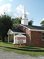
Statesville United Methodist Church
-
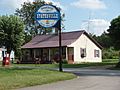
A quiet street in Statesville


Who Lives in Statesville?
| Historical population | |||
|---|---|---|---|
| Census | Pop. | %± | |
| 2020 | 82 | — | |
| U.S. Decennial Census | |||
According to the 2020 U.S. Census, about 82 people live in Statesville. This makes it a very small and quiet community.
Learning in Statesville
Students living in Statesville attend schools that are part of the Wilson County Schools system. The local schools for children in Statesville are Watertown Elementary School, Watertown Middle School, and Watertown High School.
