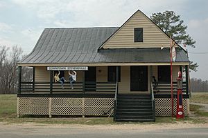
Stevensville, Virginia facts for kids
Quick facts for kids
Stevensville, Virginia
|
|
|---|---|
 |
|
| Country | United States |
| State | Virginia |
| County | King and Queen |
| Time zone | UTC−5 (Eastern (EST)) |
| • Summer (DST) | UTC−4 (EDT) |
| ZIP code |
23161
|
| Area code(s) | 804 |
| Website | [1] |
Stevensville is a small, quiet place in King and Queen County, Virginia, United States. It's known as an unincorporated community. This means it's a group of homes and businesses that don't have their own local government like a city or town. Instead, it's governed by the county.
Stevensville is mostly a farming area. You'll find it along Virginia State Route 14. It's located east of other communities like Bruington and St. Stephens Church.
Discover Stevensville, Virginia
Stevensville is a peaceful spot in the countryside of Virginia. It's a great example of a rural community. Life here often revolves around farming and the natural beauty of the area.
Where is Stevensville Located?
This community is found in the eastern part of Virginia. It's part of King and Queen County. The main road passing through Stevensville is Virginia State Route 14. You can also find it at the crossing of Virginia State Route 631 and Virginia State Route 632. These roads help connect Stevensville to nearby places.
A Glimpse into Stevensville's History
Stevensville has a connection to the American Civil War. In 1864, an important event happened near here. A Union Army officer named Colonel Ulric Dahlgren was killed. This happened during a military action near a road junction. This spot has been known as Dahlgrens Corner for a very long time, at least since 1918. It reminds us of the history that unfolded in this quiet Virginia community.
 | Selma Burke |
 | Pauline Powell Burns |
 | Frederick J. Brown |
 | Robert Blackburn |


