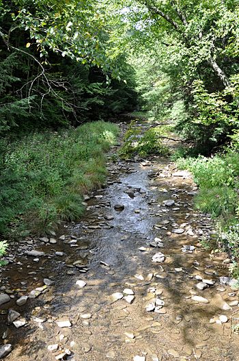
Stony Fork Creek facts for kids
Quick facts for kids Stony Fork |
|
|---|---|

Along Stony Fork Road
|
|
|
Location of the mouth of Stony Fork in Pennsylvania
|
|
| Country | United States |
| State | Pennsylvania |
| County | Tioga County |
| Physical characteristics | |
| Main source | confluence of the creek's east and west branches Tioga State Forest northwest of Morris, Tioga County 1,208 ft (368 m) 41°37′13″N 77°22′08″W / 41.62028°N 77.36889°W |
| River mouth | Babb Creek near Pennsylvania Route 414 east of Blackwell 1,201 ft (366 m) 41°34′21″N 77°20′15″W / 41.57250°N 77.33750°W |
| Length | 4.1 mi (6.6 km) |
Stony Fork Creek, often just called Stony Fork, is a small stream in Pennsylvania, United States. It flows for about 4.1 miles (6.6 kilometers) and is a branch, or tributary, of a larger stream called Babb Creek. This creek is located in Tioga County.
Where Stony Fork Begins
Stony Fork starts in the beautiful Tioga State Forest. It forms when two smaller streams, the East Branch and West Branch, join together. This starting point is located northwest of a town called Morris.
The Creek's Journey
From its beginning, Stony Fork flows generally south. As it travels, it collects water from other small streams. Two of these are Black Run and Roland Run, which both join Stony Fork from its left side. A road named Stony Fork Road follows the creek for its entire length.
Joining Babb Creek
Stony Fork's journey ends when it flows into Babb Creek. This meeting point is near a small, unnamed community called Doane. It's also close to Pennsylvania Route 414, a road that runs between Morris and Blackwell.
Babb Creek is also a tributary itself. It flows into Pine Creek, which then flows into the West Branch Susquehanna River. This means Stony Fork's water eventually becomes part of a much larger river system!
 | Bayard Rustin |
 | Jeannette Carter |
 | Jeremiah A. Brown |


