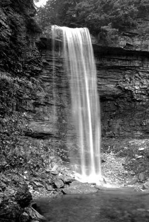
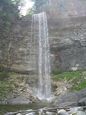
Stony Kill Falls facts for kids
Stony Kill Falls is a stunning waterfall located in Wawarsing, New York. It sits on the edge of the Minnewaska Preserve, a large natural area. This land was bought in 2001 by the State of New York, the Open Space Institute, and the New York-New Jersey Trail Conference. Before that, a company called Napanoch Sand and Gravel owned it.
For a long time, Stony Kill Falls was a secret spot. It was a hidden way into the Minnewaska Preserve. People who loved exploring or were experienced mountaineers used it. It offered an easy way to reach the falls, the creek, and a special carriage road.
Contents
Exploring Stony Kill Falls: Your Hiking Guide
When you visit Stony Kill Falls, you'll start your adventure from a parking area. You'll walk east along a gravel path that leads into an open space. As you go, you'll start to see amazing views. Tall, steep cliffs rise up on both your left and right sides.
Discovering the Aqueduct and Helipad
Higher up in this open area, you'll find a fenced-in shaft. This is a deep water valve that goes hundreds of feet underground. It connects to the Catskill Aqueduct, which is a major source of drinking water for New York City. On your right, you might spot an old helipad. This was likely used for quick repairs to the Aqueduct.
As you continue on the path, it dips down into a large gravel pit. You need to be careful here because the ground is loose. It's made of shale, so watch your step to avoid slipping. You'll see pieces of iron bars and large rocks like limestone, shale, and granite scattered around.
Along the left side of the gravel pit, there are steep banks. If you look closely into the gaps, you can see almost 60 feet down to the Stony Kill Creek. Be very careful! The edge of the bank can be thin and might be unstable, especially when it's wet. It's slowly falling into the creek and the gravel pit.
Above the Falls: A Scenic Journey
If you hike above the main falls, you'll discover a beautiful smaller waterfall, like a mini-cascade. Keep going up, and you'll find a small rock dam. This dam creates a calm pool of water above the cascade.
Beyond this pool, you can follow the river upstream for several miles. As you walk, you'll come across many more small pools and tiny waterfalls. The river gently winds its way up the hill, offering peaceful views.
Stony Kill Falls: Key Facts
Stony Kill Falls is an impressive 87 feet tall! It's one of the highest waterfalls in the Minnewaska Preserve.
After leaving the base of the falls, the trail climbs slowly up the side of the valley. Near the top, you'll see another 30-foot cascade right next to the path. This trail then connects with the Stony Kill Carriage Way at 1550 feet above sea level. From there, the path turns west towards the very top of Stony Kill Falls.
Amazing Views from the Top
The views from the top of the falls are incredible! Looking east, you can see the Stony Creek and Rondout Valleys. On a clear day, you might even see as far as Sullivan County. From the Carriage Way, you can easily reach most of the other trails in Minnewaska.
Important Safety Tips for Your Visit
- Be careful when exploring: Ice on the falls, especially at the top, is common. You might find ice from fall, through winter, and even into late spring.
- No facilities: There are no bathrooms or trash cans here. Please remember to carry out everything you bring in. Follow "leave no trace" rules and even pick up any trash you find.
- Parking caution: The road leading to the falls is very narrow. Be extra careful when parking and turning around, as there's a steep drop-off on the left side.
 | Frances Mary Albrier |
 | Whitney Young |
 | Muhammad Ali |


