Stratus cloud facts for kids
Quick facts for kids Stratus cloud |
|
|---|---|
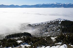
Typical stratus clouds over Skopje, North Macedonia. The mountains are higher than the cloud top, overlooking a sea of clouds.
|
|
| Abbreviation | St |
| Symbol | |
| Genus | Stratus (layered) |
| Species |
|
| Variety |
|
| Altitude | 0–2,000 m (0–7,000 ft) |
| Classification | Family C (Low-level) |
| Appearance | Gray, featureless low-altitude cloud capable of ground contact. |
| Precipitation | Common Drizzle, freezing drizzle, Snow or snow grains |
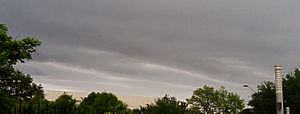
Stratus clouds are flat, gray clouds that look like a blanket across the sky. They are low-level clouds, meaning they form close to the ground. The word stratus comes from a Latin word meaning 'layer,' which perfectly describes their layered look. These clouds often bring light drizzle or a little snow. Think of them as "high fog" because they often form when morning fog lifts or when cool air moves close to the ground.
Contents
Understanding Stratus Clouds
How Stratus Clouds Form
Stratus clouds form when air near the ground gently rises. As this air goes higher, it cools down. This cooling makes the air hold more moisture, which then turns into tiny water droplets. This process happens when the air is very calm and stable.
What Stratus Clouds Look Like
Stratus clouds appear as smooth, gray or white sheets. They don't have many distinct shapes. These clouds can be made of water droplets, supercooled water (water that's colder than freezing but still liquid), or even ice crystals. What they're made of depends on how cold the air is.
Different Types of Stratus Clouds
Main Species: Nebulosus and Fractus
The most common type is Stratus nebulosus. These clouds look like a smooth, hazy veil. They don't have clear shapes or features. They often mean the weather will stay calm and steady. Stratus nebulosus can bring light rain or a few snowflakes.
Then there are Stratus fractus clouds. These look broken, ragged, or torn apart. They often form below bigger rain clouds like nimbostratus or cumulonimbus clouds. You might also see Stratus fractus clouds near mountain slopes, even without other rain clouds. Their color can range from dark gray to almost white.
How Opaque Are They?
Stratus nebulosus clouds come in two main types based on how much light they block. Stratus opacus clouds are thick and block the sun completely. Stratus translucidus clouds are thinner. You can often see the sun or moon through them, even if it's just a hazy outline.
Wavy Stratus Clouds
Sometimes, stratus clouds can have a wavy pattern. These are called Stratus undulatus. This wavy look is rare and happens when gentle winds create small disturbances in the cloud layer. You might see these waves more often when stratus clouds are changing into stratocumulus clouds.
Stratus Clouds from Other Clouds
Stratus clouds can also form from other types of clouds. For example, if a cumulus cloud spreads out, it can become a stratus cloud (Stratus cumulogenitus). They can also form from nimbostratus clouds (Stratus nimbostratogenitus) and cumulonimbus clouds (Stratus cumulonimbogenitus). Sometimes, stratus clouds even form from human activities (Stratus homogenitus), like from the spray of waterfalls (Stratus cataractagenitus), or from moisture rising from a forest (Stratus silvagenitus). They can also form when stratocumulus clouds merge together (Stratus stratocumulomutatus).
What Stratus Clouds Mean for Weather
When you see stratus clouds, it often means cloudy weather will continue for a while. They might bring light drizzle. Sometimes, stratus clouds can stay in the sky for several days, especially during calm, high-pressure weather. They can also appear when a weak warm front is moving in, instead of the heavier rain clouds you might expect.
Stratus Clouds and Climate
Stratus clouds play a big role in Earth's climate, especially in places like the Arctic. In the Arctic, stratus clouds cover about half of the sky each year. This means they greatly affect how much heat the Earth absorbs from the sun and how much heat it sends back into space.
How Stratus Clouds Compare to Others
High-Up Cirrostratus Clouds
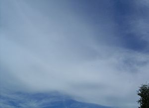
Cirrostratus clouds are very high-up clouds made of ice crystals. They can make the sky look milky or hazy. You can usually see the sun or moon clearly through them, unlike some other clouds. These clouds often create beautiful halos around the sun or moon. They form when warm, moist air slowly rises very high into the atmosphere. If you see them, it might mean a warm front is coming, and rain could arrive in about a day.
Rain-Bringing Nimbostratus Clouds
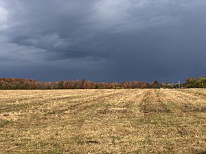
Nimbostratus clouds are dark, gray, and flat clouds. They bring steady rain or snow for a long time. These clouds are thick enough to block out the sun. They form when warm, moist air rises, cools, and turns into water droplets or ice crystals. Nimbostratus clouds often signal that a warm front is on its way.
Layered Stratocumulus Clouds
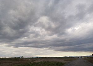
Stratocumulus clouds are low-level clouds that combine features of both stratus and cumulus clouds. Like stratus clouds, they form at low levels. But like cumulus clouds, they form from rising air. However, a strong inversion (a layer of warm air above cooler air) stops them from growing tall. This makes them flatten out into layers, similar to stratus clouds. These clouds are very common and help cool the Earth by reflecting sunlight. They can also produce light drizzle.
See also
 In Spanish: Stratus para niños


