
Sucker Brook (Lawrence Brook tributary) facts for kids
Quick facts for kids Sucker Brook |
|
|---|---|

Map of Sucker Brook
|
|
| Country | United States |
| Physical characteristics | |
| Main source | 40°27′40″N 74°27′09″W / 40.46111°N 74.45250°W |
| River mouth | 23 ft (7.0 m) 40°26′58″N 74°26′52″W / 40.44944°N 74.44778°W |
| Basin features | |
| Progression | Lawrence Brook, Raritan River, Atlantic Ocean |
Sucker Brook is a small stream in central New Jersey, United States. It's like a smaller helper stream, also known as a tributary, that flows into a bigger stream called Lawrence Brook. Eventually, its water travels all the way to the Atlantic Ocean!
Where Does Sucker Brook Flow?
Sucker Brook starts in a neighborhood where there are several small pools of water. You can find its beginning at these coordinates: 40°27′40″N 74°27′09″W / 40.46111°N 74.45250°W.
From there, the brook actually goes underground for a bit, flowing in a pipe beneath a road called Route 130. After that, it comes back out and winds its way between houses.
Finally, Sucker Brook joins Lawrence Brook. This happens near a place called Westons Mill Pond, which is a part of Lawrence Brook that has a dam. The spot where they meet is at 40°26′58″N 74°26′52″W / 40.44944°N 74.44778°W.
A Look Back in Time: Sucker Brook's History

Did you know that Sucker Brook used to flow a bit differently a long time ago? An old map from 1876 shows us how it was.
Back then, the brook crossed over several streets that exist today, like U.S. 1, Milltown Road, and others. It ended closer to Nassau Street. This shows how streams can change their paths over many years, sometimes because of nature and sometimes because of how people build things around them.
Images for kids
-
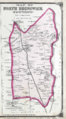
Map of North Brunswick, New Jersey, from 1876. Sucker Brook flows into Lawrence Brook below Milltown, which you can see in the upper right part of the map.
