
Lawrence Brook facts for kids
Quick facts for kids Lawrence Brook |
|
|---|---|

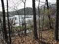
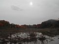
One of the few undammed sections of Lawrence Brook (below Davidsons Mill Pond)
|
|
| Country | United States |
| Physical characteristics | |
| Main source | 40°22′33″N 74°32′32″W / 40.37583°N 74.54222°W |
| River mouth | 3 ft (0.91 m) 40°29′5″N 74°23′34″W / 40.48472°N 74.39278°W |
| Basin features | |
| Progression | Raritan River, Atlantic Ocean |
| River system | Raritan River system |
| Basin size | 40 sq mi (100 km2) |
| Tributaries |
|

The Lawrence Brook is a small river in Middlesex County, New Jersey, in the United States. It flows into the Raritan River. Think of it as a smaller stream that feeds into a bigger river.
Contents
About Lawrence Brook
The Lawrence Brook was originally a stream about 10 miles (16 km) long. Over time, people built dams along it. These dams created several man-made lakes. These lakes include Deans Pond, Davidsons Mill Pond, Farrington Lake, Mill Pond, and Westons Mill Pond.
The part of the brook closest to the Raritan River is affected by the ocean's tides. This means its water level goes up and down with the ocean. Because of this, you can find marine animals living there.
Where the Water Goes
The area that collects water for Lawrence Brook is called its drainage basin or watershed. This watershed covers about 40 square miles (100 km²). It's like a big funnel that gathers all the rain and snowmelt into the brook.
Lawrence Brook and Rutgers University
A section of Lawrence Brook flows through Rutgers University's Cook Campus. This area is home to different research farms and Rutgers Gardens. It's a place where students and scientists study plants and animals.
Protecting Wildlife
Lawrence Brook is very important for wildlife. It acts as a "wildlife corridor," which is like a natural pathway for animals. Many birds use it during their yearly migrations. Because it's so important for nature, only boats with electric motors are allowed on the brook. This helps protect the sensitive environment.
History of Lawrence Brook

The native Lenape people, who lived in this area long ago, called this stream Piscopeek. The name "Lawrence Brook" came from Mr. Thomas Lawrence. He was a baker from New York City who bought land around the brook in the 1600s. You might even see old maps that spell it "Lawrence's Brook."
In the late 1800s and early 1900s, the Farrington Lake area was a popular vacation spot. There was even a trolley line that ran from New Brunswick all the way to Trenton. Farrington Lake itself was created by a dam. This dam was built above an older dam that powered a snuff mill in the mid-1800s.
Journey of Lawrence Brook
The Lawrence Brook is a long waterway that connects to the Raritan Bay. It even splits into two branches in South Brunswick. Here's how the water travels through some important places in Central New Jersey:
- Atlantic Ocean (The journey starts here, near the Raritan Bay)
- Raritan Bay to the Mouth of Raritan River (The water passes under the Governor Alfred E. Driscoll Bridge near Perth Amboy, NJ)
- Raritan River (The water continues for a few miles. A smaller branch of the Raritan River splits off near the Basilone Bridge)
- Westons Mill Pond (The water flows south and crosses Ryders Lane in East Brunswick, near the Rutgers Vegetable Garden)
- Lawrence Brook (This section connects Westons Mills Pond to Farrington Lake)
- Farrington Lake (This is the longest part of the Lawrence Brook, in the form of a lake. It flows through North Brunswick, NJ)
- Lawrence Brook (At the intersection of Riva Avenue and Davidson's Mill Road, the brook connects Farrington Lake to Davidson's Mill Pond in Deans, South Brunswick, NJ)
- Davidson's Mill Pond (The water goes under US-130 and gets narrower. It continues to Deans Pond, which is a marsh that floods sometimes.)
- Lawrence Brook (The brook continues north and northwest from Crossroads Middle School. It has been drained under the Northeast Corridor Train Track in some places. During rainy seasons, it flows near Freedom Trail in South Brunswick.)
- Lawrence Brook (It crosses the Northeast Corridor Train Track again and then enters a marsh.)
- Lawrence Brook (In the marsh, it splits into two branches:
- One branch crosses New Road and connects with the Devils Brook into Lake McCormack at Audubon’s Plainsboro Preserve.
- The other branch continues through the marsh and ends in a smaller marsh north of the Tall Timbers Cricket Park.)
Parks Along Lawrence Brook
Many parks are located along the Lawrence Brook, offering places for people to enjoy nature. These parks help protect the brook's environment.
- Davidsons Mill Pond County Park (South Brunswick)
- Ireland Brook County Park (South Brunswick and East Brunswick)
- Bicentennial Park (East Brunswick)
- North Brunswick Memorial Park (North Brunswick)
- Brook Park (Milltown)
- Mill Pond Park (Milltown)
- Rutgers Gardens and Helyar Woods (Rutgers, the State University of New Jersey)
Main Streams Feeding Lawrence Brook
Several smaller streams, called tributaries, flow into Lawrence Brook. These are like smaller arms that feed water into the main river.
- Brook from the beaver pond to Davidsons Mill Pond
- Ireland Brook
- Oakeys Brook
- Cow Yard Brook, a branch of Oakeys Brook
- Beaverdam Brook
- Sucker Brook
- Sawmill Brook
- Brook in Rutgers Gardens (along the bamboo forest), sometimes called Doc Brook
- Brook in Rutgers' Helyar Woods (with a small waterfall), sometimes called Helyar Brook
- Terhune Run
- Great Ditch
Images for kids
-
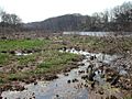
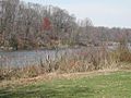
Lawrence Brook in East Brunswick
-
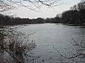
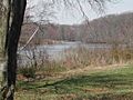
Lawrence Brook in East Brunswick
-
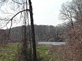
Lawrence Brook in East Brunswick
-
Lawrence Brook in East Brunswick
-
Lawrence Brook in East Brunswick
-
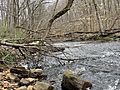
Lawrence Brook in Milltown
-
Lawrence Brook in Milltown
-
Lawrence Brook in South Brunswick


