Sumner, Oklahoma facts for kids
Quick facts for kids
Sumner, Oklahoma
|
|
|---|---|
| Country | United States |
| State | Oklahoma |
| County | Noble |
| Area | |
| • Total | 0.15 sq mi (0.38 km2) |
| • Land | 0.15 sq mi (0.38 km2) |
| • Water | 0.00 sq mi (0.00 km2) |
| Elevation | 938 ft (286 m) |
| Population
(2020)
|
|
| • Total | 35 |
| • Density | 239.73/sq mi (92.87/km2) |
| Time zone | UTC-6 (Central (CST)) |
| • Summer (DST) | UTC-5 (CDT) |
| FIPS code | 40-71500 |
| GNIS feature ID | 2812860 |
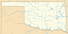
Sumner is a small community in Noble County, Oklahoma, United States. It is located about ten miles east of Perry and two miles north of U.S. Route 64. Sumner is known as an "unincorporated community," which means it doesn't have its own city government like a larger town.
History of Sumner
Sumner was started a long time ago, even before Oklahoma became a state! It was established near the St. Louis-San Francisco Railway train tracks. The community opened its own post office on May 23, 1894.
The town was named after Henry T. Sumner, who was a businessman from Perry. In 1905, a special count of people in Oklahoma Territory showed that Sumner had 64 residents. The post office in Sumner closed its doors on July 27, 1957.
Life in Sumner
At its busiest time, Sumner was a lively place. It had important buildings like a bank, a post office, two churches, and a school. There was also a grain elevator, which is a tall building used to store grain, and a stop for trains.
Today, Sumner is much smaller. It has about 50 people living there. The main buildings still in use are the Baptist church, the Christian church, and the school. These places help keep the community connected.
Population Facts
This section shares information about the number of people living in Sumner over time. This is called "demographics."
| Historical population | |||
|---|---|---|---|
| Census | Pop. | %± | |
| 2020 | 35 | — | |
| U.S. Decennial Census | |||
 | Jewel Prestage |
 | Ella Baker |
 | Fannie Lou Hamer |


