Survey of Israel facts for kids
The Survey of Israel - SOI (in Hebrew: מפ"י - המרכז למיפוי ישראל) is Israel's official organization for geodesy and map-making. Geodesy is the science of measuring and understanding the Earth's shape and gravity. Cartography is the art and science of making maps.
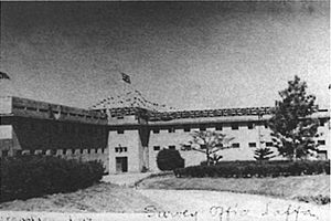
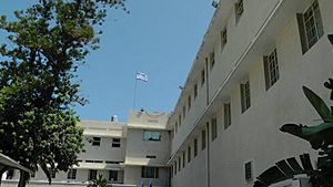
The Survey of Israel was started in 1920. Back then, it was known as the Survey of the British Mandate of Palestine. This was a time when the area was governed by Britain. The main office is in Tel Aviv. There are also smaller offices in Jerusalem, Beer Sheva, Haifa, and Nazareth. In 2011, the Israeli government decided to move all its departments into a new building in Jerusalem.
Contents
What Does the Survey of Israel Do?
The Survey of Israel is very important for understanding the land. It creates accurate maps and collects information about the Earth's surface. This helps with many things, like building new roads or planning cities.
Mapping the Land
The SOI makes different kinds of maps. These maps show details like mountains, rivers, and buildings. They are used by many people, including:
- Engineers who design new structures.
- Farmers who plan their crops.
- Hikers who explore the country.
- Scientists who study the environment.
Measuring the Earth
The team at SOI also uses special tools to measure the Earth very precisely. They use satellites and other technologies to find exact locations. This helps them create a strong base for all maps and land records. These measurements are crucial for things like property boundaries and navigation systems.
History of the Survey of Israel
The organization has a long history, starting over 100 years ago.
Early Beginnings (1920s)
The Survey of Israel began when the British ruled Palestine. Their job was to map the land for the British government. This early work laid the foundation for all future mapping in the region.
Growth and Development
After Israel became an independent country in 1948, the Survey of Israel continued its work. It became the national mapping agency for the new state. Over the years, it has used new technologies to make maps even better. This includes using aerial photographs and satellite images.
Moving to a New Home
In 2011, the government decided to build a new main office in Jerusalem. This move will bring all the different parts of the Survey of Israel together. It will help them work even more efficiently in the future.
See also
 In Spanish: Survey of Israel para niños
 | Isaac Myers |
 | D. Hamilton Jackson |
 | A. Philip Randolph |


