Takotna, Alaska facts for kids
Takotna (pronounced Tochotno’) is a small community in Alaska, United States. It's known as a census-designated place, which means it's a special area counted by the government for population. The name Tochotno’ comes from the Upper Kuskokwim language. In 2020, about 56 people lived there.
Quick facts for kids
Takotna
Tochotno’
|
|
|---|---|

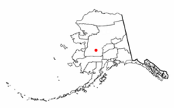
Location of Takotna, Alaska
|
|
| Country | United States |
| State | Alaska |
| Census Area | Yukon-Koyukuk |
| Area | |
| • Total | 23.40 sq mi (60.62 km2) |
| • Land | 23.40 sq mi (60.62 km2) |
| • Water | 0.00 sq mi (0.00 km2) |
| Elevation | 492 ft (150 m) |
| Population
(2020)
|
|
| • Total | 56 |
| • Density | 2.39/sq mi (0.92/km2) |
| Time zone | UTC-9 (Alaska (AKST)) |
| • Summer (DST) | UTC-8 (AKDT) |
| ZIP code |
99675
|
| Area code | 907 |
| FIPS code | 02-74610 |
| GNIS ID | 1410562 |
Where is Takotna?
Takotna is located in the Yukon-Koyukuk Census Area, Alaska. It covers an area of about 23.8 square miles (61.6 square kilometers). All of this area is land. The community is about 492 feet (150 meters) above sea level.
How Many People Live Here?
Takotna has always been a small community. It first appeared in the U.S. Census in 1930.
| Historical population | |||
|---|---|---|---|
| Census | Pop. | %± | |
| 1930 | 65 | — | |
| 1940 | 70 | 7.7% | |
| 1950 | 42 | −40.0% | |
| 1960 | 40 | −4.8% | |
| 1980 | 48 | — | |
| 1990 | 38 | −20.8% | |
| 2000 | 50 | 31.6% | |
| 2010 | 52 | 4.0% | |
| 2020 | 56 | 7.7% | |
| U.S. Decennial Census | |||
In 2000, there were 50 people living in Takotna. There were 19 households, and 12 of them were families. About 31.6% of households had children under 18. The average age of people in Takotna was 34 years old.
Getting Around
Takotna has its own airport, called Takotna Airport. It's owned by the state and is open for public use. In 2009, money was set aside to build a new airport for the community.
Education
The local school district, called the Iditarod Area School District, runs the Takotna Community School. This school helps educate the children in Takotna.
See also
 In Spanish: Takotna (Alaska) para niños
 | May Edward Chinn |
 | Rebecca Cole |
 | Alexa Canady |
 | Dorothy Lavinia Brown |

