Taku River/T'aḵú Téiú' Conservancy facts for kids
Quick facts for kids Taku River/T'aḵú Téiú' Conservancy |
|
|---|---|
|
IUCN Category II (National Park)
|
|
| Location | Stikine Region, British Columbia, Canada |
| Nearest city | Juneau |
| Area | 80,465 ha (310.68 sq mi) |
| Designation | Conservancy |
| Established | June 22, 2012 |
| Governing body | BC Parks, Taku River Tlingit First Nation |
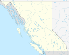
The Taku River/T'aḵú Téiú' Conservancy is a special protected area in British Columbia, Canada. It's located in the Stikine Region, a wild and beautiful part of the province. This conservancy was created on June 22, 2012. It came about after an agreement with the Taku River Tlingit First Nation to help protect this important natural space.
The conservancy protects a huge area of untouched wilderness. It follows the Taku River from where the Nakina and Inklin Rivers join it, all the way to the border with Alaska, USA.
What's in a Name?
The name T'aḵú Téiú' comes from the Tlingit language. It means "Heart of the Taku." This shows how important the Taku River is to the Tlingit people.
Exploring the Geography
The Taku River Conservancy is really big! It covers about 80,465 hectares (that's over 198,000 acres!) of wild nature. It stretches along the entire Taku River Valley. There's one small area it doesn't include, which is around the town of Tulsequah.
This conservancy shares its borders with other important natural places. To the northeast, it touches the Nakina – Inklin Rivers/Yáwu Yaa Conservancy. To the southwest, it meets the Tongass National Forest in Alaska.
One amazing natural feature you can find here is Bishop Falls. This is one of the tallest waterfalls in all of Canada! It's located along the southeastern side of the valley.
The conservancy also protects King Salmon Lake. This small lake is where King Salmon Creek begins. King Salmon Creek is the longest river that flows into the Taku River within the conservancy's protected area.
See also
- Atlin/Áa Tlein Téix'i Provincial Park
 | Kyle Baker |
 | Joseph Yoakum |
 | Laura Wheeler Waring |
 | Henry Ossawa Tanner |


