Talmage, Utah facts for kids
Quick facts for kids
Talmage, Utah
|
|
|---|---|
| Country | United States |
| State | Utah |
| County | Duchesne |
| Settled | 1907 |
| Named for | James E. Talmage |
| Elevation | 6,834 ft (2,083 m) |
| Time zone | UTC-7 (Mountain (MST)) |
| • Summer (DST) | UTC-6 (MDT) |
| ZIP codes |
84073
|
| Area code(s) | 435 |
| GNIS feature ID | 1433175 |
Talmage is a small, quiet community in the middle of Duchesne County, Utah, United States. It is an "unincorporated community," which means it does not have its own local government like a city or town. Instead, it is managed by the county.
Location and Features of Talmage
| Historical population | |||
|---|---|---|---|
| Census | Pop. | %± | |
| 1920 | 295 | — | |
| 1930 | 222 | −24.7% | |
| 1940 | 195 | −12.2% | |
| 1950 | 174 | −10.8% | |
| Source: U.S. Census Bureau | |||
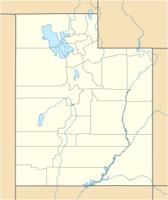
Talmage is located in central Duchesne County. It sits at a high elevation, about 6,834 feet (2,083 meters) above sea level. This makes it a place with cool air and often beautiful views. The community is found west of the current Utah State Route 87. Even though Talmage is not a city, it has its own ZIP code, which is 84073.
History of Talmage Community
The community of Talmage was first settled in 1907. When it was officially named in 1912, it was called Winn. However, just two years later, in 1914, its name was changed to Talmage. This new name honored James E. Talmage, who was an important leader in The Church of Jesus Christ of Latter-day Saints.
For many years, Talmage had its own Post Office. This Post Office was quite unique, as it was located in a small bedroom inside the home of Warner Nielsen, who was the postmaster for a long time. After Warner Nielsen passed away in 2003, the Talmage Post Office closed.
Climate in Talmage
Talmage experiences a type of weather known as a semi-arid climate. This means the area is generally dry, but it does get some rain. On climate maps, this kind of weather is often shown with the letters "BSk." This climate is common in areas that are not quite deserts but also not very wet.
 | Bessie Coleman |
 | Spann Watson |
 | Jill E. Brown |
 | Sherman W. White |


