Tamassee, South Carolina facts for kids
Quick facts for kids
Tamassee
|
|
|---|---|

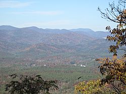
Taken from Tamassee Knob Mountain
|
|
| Country | United States |
| State | South Carolina |
| County | Oconee |
| Area | |
| • Total | 1.17 sq mi (3.02 km2) |
| • Land | 1.17 sq mi (3.02 km2) |
| • Water | 0.00 sq mi (0.00 km2) |
| Population
(2020)
|
|
| • Total | 60 |
| • Density | 51.50/sq mi (19.89/km2) |
| Time zone | UTC-5 (Eastern (EST)) |
| • Summer (DST) | UTC-4 (EDT) |
| ZIP code |
29686
|
| Area code(s) | 864 |
| FIPS code | 45-71170 |
Tamassee is a small, special place in the northwestern part of Oconee County, South Carolina, United States. It's known as an "unincorporated community" and a "census-designated place" (CDP). This means it's a recognized area, but it doesn't have its own local government like a city or town. In the year 2020, about 60 people lived here.
Contents
Discover Tamassee's Natural Beauty
The Tamassee area is very close to the amazing Blue Ridge Mountains. A big part of this community is in the beautiful Cheohee Valley. Imagine a lovely, rolling green field surrounded by tall mountains and a wide-open sky!
These mountains around the valley are part of the southern Blue Ridge Mountains. They are sometimes called the "Chattooga Escarpment." This name comes from the Chattooga River, which is a special "Wild and Scenic River" that flows nearby.
Exploring Sumter National Forest
Tamassee is next to the Pickens Ranger District of the Sumter National Forest on its west and north sides. This part of the national forest has many cool features. You can find parts of the Blue Ridge Escarpment, rivers, waterfalls, and lots of hiking trails.
The area is also famous for having many different kinds of plants and animals. Scientists believe this is because of the unique soil and the high amount of rain it gets every year. It's a great place to explore nature!
Tamassee's Rich History: Cherokee Roots
The name "Tamassee" comes from the Cherokee language. It means "Place of the Sunlight of God." Long ago, Tamassee was a Cherokee village. Stories say a powerful Cherokee prophet lived there.
The Ring Fight and Tamassee Town
Sadly, the Cherokee town of Tamassee was destroyed on August 12, 1776. This happened during a battle called the "Ring Fight." Major Andrew Pickens, a leader from the South Carolina Militia, and about 25 of his men were surprised by over 100 Cherokee and Loyalist fighters.
Major Pickens told his men to form two circles, one inside the other. When one circle fired their weapons, the other would reload. There was fierce hand-to-hand fighting with tomahawks and knives. The Militia set fire to nearby cane plants. The crackling sound made it seem like more soldiers were arriving. The Cherokee then left the town.
Later that day, the South Carolina Militiamen, led by Major Andrew Williamson, destroyed the peaceful Cherokee village and made the Cherokee leave. Today, there's a special historical marker in the Cheohee Valley. It tells the story of the Cherokee Village of "Tamassee Town."
Tamassee Today
Even today, the Tamassee area is mostly rural and agricultural. This means people still farm and live close to nature. It's a wonderful spot for a day hike, a scenic drive through the countryside, or for learning about its interesting past.
Tamassee's Population
| Historical population | |||
|---|---|---|---|
| Census | Pop. | %± | |
| 2020 | 60 | — | |
| U.S. Decennial Census 2020 |
|||
In 2020, the census counted 60 people living in Tamassee.
 | Jewel Prestage |
 | Ella Baker |
 | Fannie Lou Hamer |

