Tando Jam facts for kids
Quick facts for kids
Tando Jam
ٹنڈو جام
|
|
|---|---|
| Country | |
| Province | |
| District | Hyderabad |
| Taluka | Hyderabad |
| Government | |
| • Type | Municipal Corporation |
| Area | |
| • Town | 57.90 km2 (22.36 sq mi) |
| • Urban | 7.14 km2 (2.76 sq mi) |
| • Rural | 50.76 km2 (19.60 sq mi) |
| Elevation | 22 m (72 ft) |
| Population
(2017)
|
|
| • Town | 71,760 |
| • Density | 1,239.38/km2 (3,210.0/sq mi) |
| Time zone | UTC+5 (PST) |
| Postal code |
70050, 70060
|
| Calling code | 022 |
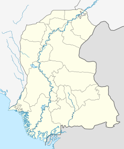
Tando Jam (which is Sindhi: ٽنڊوڄام in the local language) is a town in the Sindh province of Pakistan. It is part of the Hyderabad District. The town is about 12 kilometers northeast of Hyderabad city. In 2017, about 71,760 people lived there. Tando Jam is also home to the famous Sindh Agriculture University.
Contents
Where is Tando Jam?
Tando Jam is located to the east of the mighty Indus River. A main road, the Hyderabad-Mirpurkhas Road, goes right through the town. The town sits about 22 meters (72 feet) above sea level. This means it is not very high up.
What is Tando Jam's Climate Like?
Tando Jam has a Hot Desert Climate. This means it is usually very hot and dry. The monsoon season, when it rains the most, is from July to September. August gets the most rain, with about 39.2 mm on average. November is the driest month, with only about 1.6 mm of rain.
| Climate data for Tando Jam | |||||||||||||
|---|---|---|---|---|---|---|---|---|---|---|---|---|---|
| Month | Jan | Feb | Mar | Apr | May | Jun | Jul | Aug | Sep | Oct | Nov | Dec | Year |
| Mean daily maximum °C (°F) | 24 (75) |
28 (82) |
33 (91) |
39 (102) |
41 (106) |
40 (104) |
37 (99) |
35 (95) |
36 (97) |
36 (97) |
31 (88) |
26 (79) |
34 (93) |
| Daily mean °C (°F) | 18 (64) |
21 (70) |
26 (79) |
31 (88) |
33 (91) |
33 (91) |
32 (90) |
31 (88) |
30 (86) |
29 (84) |
24 (75) |
19 (66) |
27 (81) |
| Mean daily minimum °C (°F) | 12 (54) |
15 (59) |
19 (66) |
24 (75) |
27 (81) |
28 (82) |
28 (82) |
27 (81) |
26 (79) |
23 (73) |
18 (64) |
13 (55) |
22 (71) |
| Average rainfall mm (inches) | 2.1 (0.08) |
1.8 (0.07) |
3.3 (0.13) |
2.8 (0.11) |
2.3 (0.09) |
6.7 (0.26) |
28.9 (1.14) |
39.2 (1.54) |
18.4 (0.72) |
2.5 (0.10) |
1.6 (0.06) |
2.4 (0.09) |
112 (4.39) |
| Average rainy days (≥ 1 mm) | 0.5 | 0.3 | 0.4 | 0.6 | 0.3 | 0.9 | 3.3 | 3.4 | 1.5 | 0.5 | 0.3 | 0.4 | 12.4 |
| Mean daily daylight hours | 10.8 | 11.3 | 12.0 | 12.8 | 13.4 | 13.7 | 13.5 | 13.0 | 12.3 | 11.5 | 10.9 | 10.6 | 12.1 |
| Source: Weatherspark.com | |||||||||||||
Villages in Tando Jam
In 2017, four villages were managed by the Tando Jam Municipal Committee. A municipal committee is like a local government that helps run the town and nearby areas. These four villages made up almost half (45.82%) of the total population of Tando Jam. Here are the villages:
| Villages | Population (2017) | Area (km2) |
|---|---|---|
| Abri | 11,569 | 21.65 |
| Bhimpur | 5,630 | 7.36 |
| Rais | 4,414 | 6.52 |
| Sipki | 11,265 | 15.24 |
Who Lives in Tando Jam?
| Religion in rural localities of Tando Jam | ||||
|---|---|---|---|---|
| Religion | Percent | |||
| Islam | 83.16% | |||
| other | 16.84% | |||
According to the 2017 Pakistani Census, Tando Jam had 71,760 residents. This count helps us understand how many people live in an area. There were 37,760 males, 33,994 females, and 6 transgenders. On average, each household had about 5.20 people living together.
In the rural areas around Tando Jam, about 40.47% of people could read and write. This is called the literacy rate. More males were literate (51.94%) than females (27.96%) in these areas.
 | Jewel Prestage |
 | Ella Baker |
 | Fannie Lou Hamer |


