Tauhoa facts for kids
Quick facts for kids
Tauhoa
|
|
|---|---|

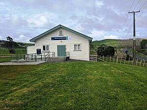
Tauhoa (Victoria) Hall
|
|
| Country | New Zealand |
| Region | Auckland Region |
| Local board | Rodney Local Board |
| Subdivision | Wellsford subdivision |
| Electorates |
|
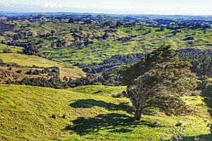
Tauhoa is a small rural community located in the Auckland Region of New Zealand's North Island. It's a peaceful area with lots of farmland.
State Highway 16 passes through Tauhoa. This main road connects it to Wellsford, about 15 kilometers (9 miles) to the north-east. It also links to Glorit, which is 12 kilometers (7 miles) south. The Te Pahi Stream flows through the area. It then joins the Tauhoa River, which eventually empties into the southern Kaipara Harbour to the west.
Tauhoa's History: A Look Back
Early European Settlement
The land around Tauhoa was bought from Māori chiefs, including Te Keene, in 1867. This area, along with the Hoteo block, covered a huge 41,400 acres. Land was first offered for sale to new settlers in 1868. However, some parts were still being surveyed for future homes as late as 1875. Some settlers even left their land in the 1880s.
Kauri Logging and Transport
In the 1880s, a special tramway was used here. It helped bring huge kauri logs down to the Te Pahi Stream. From there, sailing ships could pick up the logs and take them away. One ship, the Mary Mildred, got stuck and wrecked in the Tauhoa River while carrying kauri. A small steamboat called the S.S. Mary Allen was built in Tauhoa. It carried goods between Te Pahi Creek and the northern Wairoa River in the early 1880s.
Roads and Travel
A local board managed the roads in Tauhoa from 1876 to 1906. By 1880, the road heading north to Port Albert was good for summer travel. By 1886, a route south to Kaukapakapa was finished and had bridges. But it was still hard to use in winter. A small part of the road in Tauhoa was covered with metal (like gravel) in 1899. In the late 1920s, the road from Tauhoa to the Hoteo railway station became a main highway and was metalled. Most other roads in the area were metalled by the mid-1930s.
Gum Diggers and Farming
Before 1910, people known as Gum-diggers were busy in the area. They dug up kauri gum, which was used for things like varnish. Today, Tauhoa is a good place for farming. But in the past, life was tough for some settlers. They even called the area around Linton Road 'Strugglers Gully'.
Who Lives in Tauhoa? (Demographics)
Tauhoa is a small community with a growing population. In the 2023 New Zealand census, 168 people lived here. This was a good increase from previous years!
Population Details
- Age Groups: About a quarter of the people (25%) are under 15 years old. This means there are many kids and teens in Tauhoa!
- Ethnicity: Most people (91.1%) are European (also called Pākehā). About a third (33.9%) are Māori. Some people belong to more than one ethnic group.
- Languages: Everyone in Tauhoa speaks English. A small number (3.6%) also speak the Māori language.
- Born Overseas: About 16% of the people in Tauhoa were born outside New Zealand.
- Religion: Many people (66.1%) said they had no religion. Some are Christian (23.2%), and a few follow Māori religious beliefs.
- Jobs and Income: Many adults in Tauhoa work full-time (50%). The average income here is about $39,900 per year.
Local Māori Culture: Puatahi Marae
The local Puatahi Marae is a very important place. It's a traditional meeting ground for the local Māori community. A marae is a special place where people gather for important events, discussions, and celebrations.
Puatahi Marae is connected to the Ngāti Whātua tribe and their groups, Ngāti Whātua o Kaipara, Ngāti Hine, and Ngāti Rāngo or Rongo. The marae has a special meeting house called Te Manawanui (a wharenui).
Learning in Tauhoa: Tauhoa School
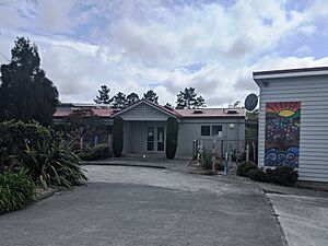
Tauhoa School is a primary school for students from Year 1 to Year 8 (ages 5-13). It's a coeducational school, meaning both boys and girls attend. As of February 2024 , there are 58 students. The school celebrated its 125th birthday in 2004, showing it has a long history of educating children in the community!
 | Jackie Robinson |
 | Jack Johnson |
 | Althea Gibson |
 | Arthur Ashe |
 | Muhammad Ali |


