
Te Papapa facts for kids
Quick facts for kids
Te Papapa
|
|
|---|---|
|
Suburb
|
|

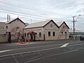
A carpet factory in the south of the suburb
|
|

Te Papapa
Location in New Zealand
|
|
| Country | New Zealand |
| Local authority | Auckland |
| Electoral ward | Maungakiekie-Tāmaki ward |
| Local board | Maungakiekie-Tāmaki Local Board |
| Board subdivision | Maungakiekie |
| Area | |
| • Land | 71 ha (175 acre) |
| Population
(June 2023)
|
|
| • Total | 3,420 |
| Train station(s) | Te Papapa railway station |
|
|
||
Te Papapa is a suburb in Auckland, New Zealand. It is about nine kilometres southeast of Auckland city centre. The suburb sits on the northern shore of the Māngere Inlet. This inlet is a part of the Manukau Harbour.
Te Papapa is located between the suburbs of Onehunga, Penrose, and Southdown. It is also at the northern end of the Māngere Bridge. This bridge connects Te Papapa to the South Auckland suburb of Māngere.
Train services run through Te Papapa on the Onehunga Branch line. This line is part of the Onehunga Line. The train services at Te Papapa station started on September 19, 2010.
The name "Te Papapa" might come from an old fortress. This fortress was said to be built from rock slabs. However, when the railway station first opened, the area was known as "Pumpkin Flat." The railway manager chose the name "Te Papapa" to remember the "Maori long pumpkin."
About the People of Te Papapa
Te Papapa covers an area of about 0.71 square kilometres. As of June 2023, , it has an estimated population of 3,420 people. This means there are many people living in a small area.

In 2018, 3,237 people lived in Te Papapa. This was an increase from previous years. There were slightly more females than males. The average age of people living here was 34.2 years. This is a bit younger than the national average for New Zealand.
About one-fifth of the people were under 15 years old. Many adults were between 30 and 64 years old.
People in Te Papapa come from many different backgrounds. Over half of the residents are European/Pākehā. There are also many Māori, Pacific peoples, and Asian residents. About 35% of the people were born outside New Zealand.
When it comes to beliefs, many people in Te Papapa do not have a religion. However, a large number are Christian. Some people also follow Hindu, Muslim, or Buddhist faiths.
Many adults in Te Papapa have a university degree or higher. Most people aged 15 and over are employed. They work full-time or part-time.
Learning in Te Papapa
Te Papapa School is a primary school in the area. It is for students in years 1 to 6. The school is for both boys and girls. As of February 2024. , it has 277 students.
Images for kids
-
A carpet factory in the south of the suburb
