Tebbetts, Missouri facts for kids
Quick facts for kids
Tebbetts, Missouri
|
|
|---|---|

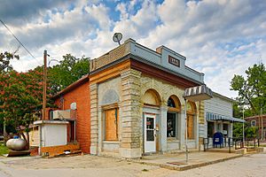
Tebbetts, Missouri Bank Spring 2012
|
|

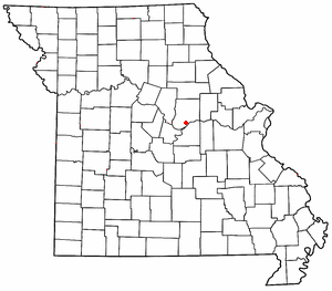
Location of Tebbetts in Missouri
|
|
| Country | United States |
| State | Missouri |
| County | Callaway |
| Area | |
| • Total | 0.68 sq mi (1.75 km2) |
| • Land | 0.65 sq mi (1.68 km2) |
| • Water | 0.03 sq mi (0.07 km2) |
| Elevation | 568 ft (173 m) |
| Population
(2020)
|
|
| • Total | 64 |
| • Density | 98.46/sq mi (37.99/km2) |
| ZIP code |
65080
|
| Area code(s) | 573 |
| FIPS code | 29-70342 |
| GNIS feature ID | 727509 |
Tebbetts is a small community in southern Callaway County, Missouri, United States. It is called an "unincorporated community" because it doesn't have its own city government. Tebbetts is part of the larger Jefferson City, Missouri area. In 2020, about 64 people lived there.
Discovering Tebbetts
Tebbetts is located on Route 94. It is about 8 miles (13 kilometers) east of Jefferson City. The community sits on the northern edge of the Missouri River floodplain, which is a flat area of land next to the river.
A Look at Tebbetts' Past
Tebbetts has a history that goes back to the late 1800s. A post office opened in Tebbetts in 1895. The community was named after someone who worked for the railroad.
Important Places in Tebbetts
Even though it's a small place, Tebbetts has some important historical sites. These sites are special enough to be listed on the National Register of Historic Places. This list helps protect important places in the United States.
- The Cote Sans Dessein Archeological Site is one of these important places. It is a site where people can learn about the past.
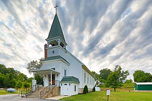
- The Oakley Chapel African Methodist Episcopal Church is another historic building in Tebbetts. It is an important part of the community's history.
 | James Van Der Zee |
 | Alma Thomas |
 | Ellis Wilson |
 | Margaret Taylor-Burroughs |


