Tehuacana, Texas facts for kids
Quick facts for kids
Tehuacana, Texas
|
|
|---|---|
 |
|

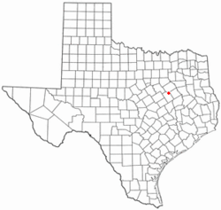
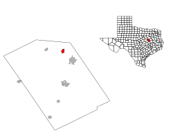
Location of Tehuacana, Texas
|
|
 |
|
| Country | United States |
| State | Texas |
| County | Limestone |
| Named for | The Tehuacana people |
| Area | |
| • Total | 1.59 sq mi (4.11 km2) |
| • Land | 1.58 sq mi (4.09 km2) |
| • Water | 0.01 sq mi (0.02 km2) |
| Elevation | 640 ft (195 m) |
| Population
(2020)
|
|
| • Total | 228 |
| • Density | 143.4/sq mi (55.47/km2) |
| Time zone | UTC-6 (Central (CST)) |
| • Summer (DST) | UTC-5 (CDT) |
| ZIP code |
76686
|
| Area code(s) | 254 |
| FIPS code | 48-72080 |
| GNIS feature ID | 1376406 |
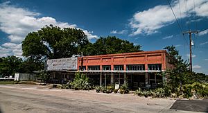
Tehuacana (pronounced "tuh-WAH-kuh-nuh") is a small town in Limestone County, Texas, United States. It is located near the Tehuacana Hills. In 2020, about 228 people lived there. For many years, from 1869 to 1902, Tehuacana was home to Trinity University.
Contents
History of Tehuacana
Early Beginnings and Name Origins
The area now known as Tehuacana got its first post office in 1847. It was called "Tewockony Springs." This name came from the Tawakoni Indians, who lived in this region until the late 1840s.
In 1850, Tehuacana almost became the capital city of Texas! There was an election to choose the new state capital, and Tehuacana came in second place. Austin won the election instead.
Tehuacana Academy and Post Office Changes
A school called Tehuacana Academy opened in 1852. Around this time, the community started being known as Tehuacana Hills. However, the post office kept its original name, "Tewockony Springs."
During the Civil War, the post office stopped operating for a while. But in 1869, postal service started again. At that point, the post office's name was officially changed to Tehuacana.
Where is Tehuacana?
Tehuacana is located in Texas at these coordinates: 31°44′32″N 96°32′44″W / 31.74222°N 96.54556°W. This helps people find its exact spot on a map.
The town covers a total area of about 1.6 square miles (4.1 square kilometers). All of this area is land.
People of Tehuacana
Population Over Time
The number of people living in Tehuacana has changed over the years. Here's how the population has looked:
| Historical population | |||
|---|---|---|---|
| Census | Pop. | %± | |
| 1900 | 382 | — | |
| 1910 | 425 | 11.3% | |
| 1920 | 614 | 44.5% | |
| 1930 | 412 | −32.9% | |
| 1940 | 408 | −1.0% | |
| 1950 | 389 | −4.7% | |
| 1960 | 316 | −18.8% | |
| 1970 | 285 | −9.8% | |
| 1980 | 265 | −7.0% | |
| 1990 | 322 | 21.5% | |
| 2000 | 307 | −4.7% | |
| 2010 | 283 | −7.8% | |
| 2020 | 228 | −19.4% | |
| U.S. Decennial Census 2020 Census |
|||
Who Lives in Tehuacana?
In 2000, there were 307 people living in Tehuacana. These people lived in 132 households, and 86 of those were families. The town had about 190 people per square mile.
Most of the people in Tehuacana in 2000 were White (89.25%). There were also African American residents (7.49%) and people from other backgrounds. About 2.93% of the population identified as Hispanic or Latino.
Households and Families
Out of the 132 households, about 30% had children under 18 living with them. More than half (54.5%) were married couples living together. About 34% of households were made up of individuals living alone.
The average household had 2.33 people, and the average family had 2.89 people.
Age and Income
In 2000, the population was spread out by age. About 23.5% were under 18 years old. About 15.3% were 65 years or older. The average age in Tehuacana was 42 years old.
The average income for a household in the town was $35,469. For families, the average income was $51,250.
Education in Tehuacana
Students in Tehuacana attend schools that are part of the Mexia Independent School District.
Famous People from Tehuacana
One notable person connected to Tehuacana is Benjamin Franklin Yoakum. He was born near the town. Yoakum became a very important railroad executive. He helped shape how trains and transportation developed across Texas and the entire Southwest region of the United States.
See also
 In Spanish: Tehuacana (Texas) para niños

