Teigen, Montana facts for kids
Quick facts for kids
Teigen
|
|
|---|---|
| Country | United States |
| State | Montana |
| County | Petroleum |
| Elevation | 3,192 ft (973 m) |
| Time zone | UTC-7 (Mountain (MST)) |
| • Summer (DST) | UTC-6 (MDT) |
| ZIP codes |
59084
|
| GNIS feature ID | 777448 |
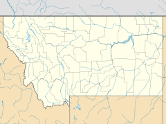
Teigen was once a small, spread-out community in Petroleum County, Montana, in the United States. It was located along Highway 200, about 20 miles west of Winnett. The area is about 3,192 feet (973 meters) above sea level.
Even though Teigen is still shown on many maps, like Google Maps, there are no buildings left from the original community today. Only one nearby home remains.
History of Teigen
The story of Teigen began in 1884. A man named Mons Teigen started a sheep ranch in this area. He worked with Knute and Ole Opheim. By 1897, Mons Teigen owned the ranch all by himself.
In 1914, a company called the Milwaukee Land Company planned out the town of Teigen. The same year, a post office opened in Teigen. This post office served the community until it closed on December 21, 1983. Even though the post office is gone, the area still has its own ZIP code, 59084. Mail for this area is now handled by the post office in Winnett.
Climate in Teigen
The climate in Teigen is known as a semi-arid climate. This means the area is quite dry, but it's not a desert. It gets some rain, but not a lot. On climate maps, this type of weather is often shown as "BSk."


