Terrell Branch (Hyco River tributary) facts for kids
Quick facts for kids Terrell Branch |
|
|---|---|
|
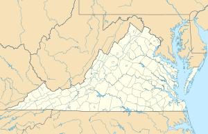
Location of Terrell Branch mouth
|
|
| Other name(s) | Tributary to Hyco River |
| Country | United States |
| State | Virginia |
| County | Halifax |
| Physical characteristics | |
| Main source | Grassy Creek divide about 1.5 miles southwest of Omega, Virginia 418 ft (127 m) 36°39′10″N 078°49′42″W / 36.65278°N 78.82833°W |
| River mouth | Hyco River about 2.5 miles south of Omega, Virginia 319 ft (97 m) 36°38′21″N 078°48′39″W / 36.63917°N 78.81083°W |
| Length | 1.51 mi (2.43 km) |
| Basin features | |
| Progression | southeast |
| River system | Roanoke River |
| Basin size | 1.15 square miles (3.0 km2) |
| Tributaries |
|
| Bridges | none |
Terrell Branch is a small stream, about 1.5 miles (2.4 kilometers) long, located in Halifax County, Virginia. It's like a small helper stream that flows into a bigger river called the Hyco River. When a small stream flows into a larger one, it's called a tributary. Terrell Branch is a "first-order" tributary, which means it's one of the smallest streams that doesn't have other streams flowing into it before it joins a bigger river.
Contents
Where Does Terrell Branch Start and Go?
Terrell Branch begins about 1.5 miles (2.4 kilometers) southwest of a place called Omega, Virginia. It starts at an elevation of about 418 feet (127 meters) above sea level. From there, it flows towards the southeast.
Joining the Hyco River
After its short journey, Terrell Branch meets and joins the Hyco River. This meeting point is about 2.5 miles (4 kilometers) south of Omega, Virginia. At this spot, the elevation is about 319 feet (97 meters) above sea level. The Hyco River itself is part of an even larger river system, the Roanoke River.
What is the Terrell Branch Watershed Like?
A watershed is an area of land where all the water drains into a common stream, river, or lake. The Terrell Branch watershed covers about 1.15 square miles (2.98 square kilometers).
Rain and Forests in the Area
This area gets a good amount of rain, about 45.7 inches (116 centimeters) each year. A large part of the watershed, about 89%, is covered by forests. This means there are lots of trees that help keep the water clean and the soil healthy.
 | Mary Eliza Mahoney |
 | Susie King Taylor |
 | Ida Gray |
 | Eliza Ann Grier |


