Thal (district) facts for kids
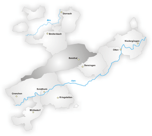
Thal is a special area, like a county, located right in the middle of Solothurn. Solothurn is one of Switzerland's many regions, called cantons. Thal is one of ten such districts in Solothurn.
What Makes Up Thal?
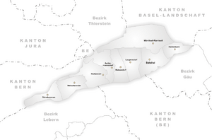
The Thal district is made up of several smaller towns and villages. These are called municipalities. Each municipality has its own local government. Together, they form the district of Thal.
Here are the municipalities that are part of Thal:
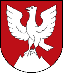
| Coat of arms | Municipality | Population (Dec 2005) |
Area, km² |
|---|---|---|---|
| Aedermannsdorf | 534 | 12.88 | |
| Balsthal | 5810 | 15.69 | |
| Gänsbrunnen | 96 | 11.36 | |
| Herbetswil | 585 | 16.35 | |
| Holderbank | 663 | 7.79 | |
| Laupersdorf | 1685 | 15.52 | |
| Matzendorf | 1314 | 11.29 | |
| Mümliswil-Ramiswil | 2542 | 35.48 | |
| Welschenrohr | 1162 | 12.97 | |
| Total | 14,391 | 139.33 |
In total, the district of Thal had a population of 14,391 people as of December 2005. The total area of the district is about 139.33 square kilometers. This makes it a moderately sized district within the canton of Solothurn.
See also
 In Spanish: Distrito de Thal para niños
Black History Month on Kiddle
Famous African-American Artists:
 | Delilah Pierce |
 | Gordon Parks |
 | Augusta Savage |
 | Charles Ethan Porter |

All content from Kiddle encyclopedia articles (including the article images and facts) can be freely used under Attribution-ShareAlike license, unless stated otherwise. Cite this article:
Thal (district) Facts for Kids. Kiddle Encyclopedia.


