Thanh Hóa province facts for kids
Quick facts for kids
Thanh Hóa province
Tỉnh Thanh Hóa
|
|
|---|---|
|
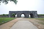
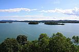
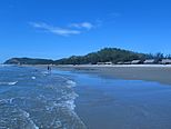
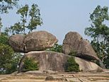
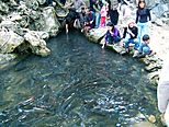
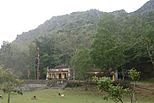
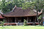
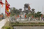
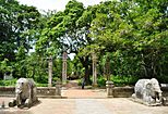
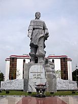
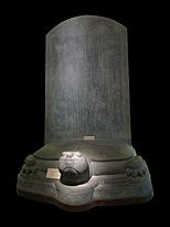
Citadel of the Hồ Dynasty • Sông Mực Lake • Hải Hòa Beach • Trống Mái Mountain • Cẩm Lương fish stream • Mai An Tiêm Temple • Lam Kinh Temple • Phú Lệ Suspension bridge • Bà Triệu Temple • Dạ Lộc Temple • Lê Lợi Mausoleum • Lê Lợi Statue
|
|
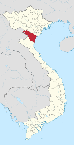
Location of Thanh Hóa within Vietnam
|
|
| Country | |
| Region | North Central Coast |
| Capital (and Largest city) | Thanh Hóa |
| Area | |
| • Total | 11,129.5 km2 (4,297.1 sq mi) |
| Population
(2021)
|
|
| • Total | 3,673,900 |
| • Density | 330.105/km2 (854.967/sq mi) |
| Demographics | |
| • Ethnicities | Vietnamese, Mường, Thái, Thổ, Dao, and H'Mông |
| Time zone | UTC+7 (ICT) |
| Area codes | 237 |
| ISO 3166 code | VN-21 |
Thanh Hóa is a large province located in the central part of Vietnam. It is the northernmost province along the coast in the North Central Coast region. Thanh Hóa shares its borders with several other provinces. To the north, it borders Sơn La, Hòa Bình, and Ninh Bình. To the south, it borders Nghệ An. To the west, it has a long border (over 192 km) with Houaphanh in Laos. To the east, it meets the East Sea, specifically the Gulf of Tonkin.
Thanh Hóa is a very big province. It ranks fifth in size and third in population among all 63 administrative areas in Vietnam. Its main city and capital is Thanh Hóa City. People often call the province Xứ Thanh, which means "The Land of Thanh."
People have lived in Thanh Hóa for a very long time, about 6,000 years! It was one of the first places where ancient Vietnamese culture developed. Scientists have found signs of an old culture called the Đa Bút Culture here. This culture was found along the Sông Đáy and Sông Mã rivers.
Thanh Hóa is special because it sits right in the middle of North Vietnam and the North Central Coast. This means it's a place where different types of land, weather, and local cultures meet. Because of this, Thanh Hóa has many unique local traditions and customs.
The province has two main cities, one town, and 24 rural districts. Its total area is about 11,133.4 square kilometers, and around 3.6 million people live there. Sầm Sơn city is a popular beach resort, located just 16 kilometers from Thanh Hóa city. Bỉm Sơn is a big industrial town, known for making cement. Nghi Sơn is a growing economic area. It is expected to become a major industrial hub for Thanh Hóa. It has a large refinery, a deepwater seaport, and many new projects.
Thanh Hóa is also home to many different ethnic groups. The seven main groups are the Kinh (Vietnamese), Mường, Thái, H'Mông, Dao, Thổ, and Khơ-mú.
Contents
Discovering Thanh Hóa's Location
Thanh Hóa is located at specific points on the map. Its northernmost point is at 20°40'N, and its southernmost point is at 19°18'N. For its width, the westernmost point is at 104°22'E, and the easternmost point is at 106°05'E. These coordinates help us find Thanh Hóa precisely on a world map.
How Thanh Hóa is Organized
Thanh Hóa province is divided into 27 smaller areas. These are like different neighborhoods or regions within the province.
- 23 rural districts:
-
- Bá Thước
- Cẩm Thủy
- Đông Sơn
- Hà Trung
- Hậu Lộc
- Hoằng Hóa
- Lang Chánh
- Mường Lát
- Nga Sơn
- Ngọc Lặc
- Như Thanh
- Như Xuân
- Nông Cống
- Quan Hóa
- Quan Sơn
- Quảng Xương
- Thạch Thành
- Thiệu Hóa
- Thọ Xuân
- Thường Xuân
- Triệu Sơn
- Vĩnh Lộc
- Yên Định
- 2 district-level towns:
-
- Bỉm Sơn
- Nghi Sơn
- 2 provincial cities:
- Thanh Hóa (the capital city)
- Sầm Sơn
These 27 areas are then further divided into even smaller parts. These include 28 towns (or townlets), 579 communes (like small villages or rural areas), and 30 wards (parts of a city).
What Does "Thanh Hóa" Mean?
The name "Thanh Hóa" comes from two words in Sino-Vietnamese. These are "Thanh" (清) and "Hóa" (化).
- "Thanh" (清) means "clear," "pure," or "fine."
- "Hóa" (化) means "to transform," "to change into," or "to become."
So, the name "Thanh Hóa" suggests a place that is clear, pure, or perhaps a place that is changing and developing.
See also
 In Spanish: Provincia de Thanh Hóa para niños
 | Calvin Brent |
 | Walter T. Bailey |
 | Martha Cassell Thompson |
 | Alberta Jeannette Cassell |


