
The Avenues, Salt Lake City facts for kids

The Avenues is a cool neighborhood in Salt Lake City, Utah. It got its name from its super organized streets. These streets are laid out like a grid, with "Avenues" (numbered 1st to 18th) and "Streets" (lettered A to V).
The Avenues was one of the very first neighborhoods in Salt Lake City. It was first mapped out way back in the 1850s. Today, many people think of the Avenues as a place where younger, creative people live. It's also known for being a strong area for the Utah Democratic Party, which is one of the main political groups in the state.
Contents
Exploring the Avenues: Where is it?
_map.png)
The Avenues neighborhood is located on the "north east bench" of the Wasatch Mountains in Salt Lake City. Imagine it sitting on the lower slopes of the mountains.
Its southern edge is South Temple Street. As you go north, the neighborhood climbs up the hillside.
How are the Streets Organized?
The streets that run north-south (up the hill) start at Canyon Road. Then they are lettered from "A" to "U" Street, and finally "Virginia Street." These go from west to east.
The streets that run east-west (mostly flat) are numbered 1st to 18th Avenues. These go northward from South Temple Street. Around 13th Avenue, the perfect grid starts to change. Newer areas further north have more winding roads.
Some of the main streets for driving through include B, E, I, and Virginia. The main avenues are 2nd, 3rd, 6th, 11th, and 13th.
What's Around the Avenues?
The Avenues is just northeast of downtown Salt Lake City. It's also just east of Capitol Hill, across City Creek Canyon.
To the east of the lower Avenues (below 11th Avenue) is a neighborhood called Federal Heights. This area is often seen as wealthier than the Avenues. It has bigger, grander homes. North of Federal Heights is a newer area called Arlington Hills. The Avenues can be quite steep as they climb the foothills.
Parks and Important Places
The large Salt Lake City Cemetery takes up a big part of the eastern Avenues. It's next to Lindsey Gardens, which is a park. North of 11th Avenue, you'll find the 11th Avenue Park.
The "lower Avenues" (below 11th or 13th Avenue) has many older houses. Most of these homes were built a long time ago, between 1880 and 1920. In the past, many young people bought these houses to fix them up. Now, it's becoming harder for young people to afford them. There are also many apartment buildings in the lower Avenues.
The Avenues is a popular place to live because it's close to downtown. It's also near the beautiful Memory Grove and City Creek Canyon, which are great for outdoor activities. The University of Utah is to the east, and the airport is not too far. The area has low traffic and not many big stores.
There's a supermarket with a few small shops between E and F Streets and 5th and 6th Avenue. The LDS Hospital complex is also in the Avenues. It covers several blocks between 7th and 9th Avenues, and C and D Streets. Shriners Hospital for Children is on Virginia Street near 11th Avenue. You can find Popperton Park at the corner of Virginia and 11th Avenue. There's also a small city library branch at 9th Avenue and F Street. The Avenues has several schools and churches too.
A Look Back: History of the Avenues

The Avenues was the first part of Salt Lake City that didn't follow the original city plan. The city's first blocks were very large, but the Avenues had smaller blocks. This meant the streets in the Avenues didn't line up perfectly with the older streets at the bottom of the neighborhood.
The first lots were mapped out in the early 1850s. But the way the Avenues was planned was against the law at the time! So, the government had to pass a new law in 1860 just for the Avenues.
How the Streets Got Their Names
Originally, all the streets had names. The north-south streets were named after trees. The east-west streets had names like "Fruit" and "Garden."
By 1885, the north-south streets got their current letter names (A Street through V Street). However, the east-west streets were still called "Streets." They didn't become "Avenues" until 1907. Before that, people called the area "the dry bench" because it didn't have much water.
Water Problems and Solutions
Until 1884, people living in the northeastern Avenues had to carry water to their homes every day. This was a lot of work! People protested, and the city finally put in pipelines along 6th Avenue. But people in the higher Avenues didn't get water until 1908.
Even with water problems, the Avenues was a popular place to live. People who worked as artisans (skilled craftspeople) liked living close to downtown.
Getting Around: Trolleys!
Transportation was a big reason people moved to the Avenues. In 1872, the Salt Lake Railway Company started offering rides on mule and horse-drawn trolleys in the Avenues. These trolleys became electric in 1889.
Different trolley companies competed until they joined together in 1903. The trolley system grew to other parts of the city. But the Avenues had more trolley lines than almost anywhere else in the city! The trolley tracks were removed in the 1940s.
Around the year 1900, the Avenues was a popular neighborhood for middle and upper-middle class families. Many professionals lived there. Important people, like Heber J. Grant (who later became a leader of the Church of Jesus Christ of Latter-day Saints), encouraged people to buy homes in the Avenues.
Changes Over Time
Over the years, other wealthy neighborhoods like Federal Heights became more popular. The Avenues became less popular. By the 1960s, some homes were not being taken care of very well.
To help fix these problems, residents created the Greater Avenues Community Council (GACC). This group worked to make the neighborhood a great place to live again. Today, the Avenues has been revitalized. Many people now think it's one of the best neighborhoods in Salt Lake City!
Avenues Historic District
Quick facts for kids |
|
|
Avenues Historic District
|
|
| Lua error in Module:Location_map at line 420: attempt to index field 'wikibase' (a nil value). | |
| Location | Roughly bounded by 1st and 9th Aves., State and Virginia Sts., Salt Lake City, Utah |
|---|---|
| Area | 487 acres (197 ha) |
| Built | 1850 |
| Architect | Multiple |
| Architectural style | Mixed |
| NRHP reference No. | 80003915 |
| Added to NRHP | August 27, 1980 |
The Avenues Historic District is a special area that is 487-acre (197 ha) big. It was added to the National Register of Historic Places in 1980. This means it's recognized as an important historical place. The district includes 143 important buildings and one special historical site, Brigham Young's Grave.
Some houses in the district are very unique. For example, the Barlow House is a brick house built in the Queen Anne style. It has a twin house, the Amanda Conk Best House, which was built in a rural area.
Also, the Arthur O. Clark House at 1059 East 3rd Avenue, built in 1895, is an exact copy of the Oscar M. Booth House. That house was built in 1893 in Nephi, Utah.
Images for kids
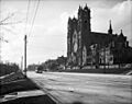
-
The Cathedral of the Madeleine near the Avenues in 1908.
