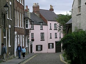
The Bailey facts for kids
The Bailey is a very old and important part of Durham City in England. It has two main streets: North Bailey and South Bailey. This area sits on a piece of land called a peninsula. It's almost surrounded by a big bend in the River Wear.
The name "The Bailey" comes from the old Durham Castle. It was once the "outer bailey" or outer yard of the castle. Cars cannot easily drive into this area. This is because of the Durham City congestion charge. This charge started in 2002 and was the first of its kind in the UK.
Contents
Discovering Durham's Peninsula
The whole area inside the river's bend is known as "The Peninsula." This includes the famous Durham Castle and Cathedral, Palace Green, and the streets of North Bailey, South Bailey, and Saddler Street. It's a special part of Durham City.
What are Bailey Colleges?
Five colleges of Durham University are in this historic area. These are University College, Hatfield College, St Chad's College, St John's College, and St Cuthbert's Society. They are often called the Bailey Colleges. However, only four of them are actually on the Bailey streets. University College is on Palace Green.
Exploring The Bailey's Streets
The Bailey is made up of two main streets: South Bailey and North Bailey. They are full of history and old buildings.
South Bailey's Charm
South Bailey starts near St Cuthbert's Society. This is close to Prebends Bridge at the southern tip of the peninsula. The street is covered in old cobblestones. Many of its buildings belong to Durham Cathedral and Durham University. As you walk north, you pass St John's College. South Bailey then turns into North Bailey. This happens at the gate to "the College." This is a private square with homes for the Cathedral's Dean and Canons. The Chorister School is also here.
North Bailey's Path
North Bailey continues from "the College." It has Hatfield College and St Chad's College. Many university departments are also along this street. Some of these buildings are newer. North Bailey ends where it meets Owengate. Owengate leads up to Palace Green.
Palace Green: A World Heritage Site
Palace Green is a large grassy area. It sits between Durham Cathedral and Durham Castle. The Cathedral and Castle together are a UNESCO World Heritage Site. This means they are very important to the world. Palace Green itself was added to this special site in 2008. It is on top of the narrow, high peninsula. This land was formed by a sharp bend in the River Wear.
On the east side of Palace Green are university buildings. These include departments for law, theology, classics, and history. To the west, you'll find the music department. The university's special collections library is also there. You can reach Palace Green from the north and east by Owengate and Dun Cow Lane. Dun Cow Lane gets its name from an old local story. From the west, a narrow path called "Windy Gap" leads down to the River Wear.
Durham Market Place: City Heart
The rest of the peninsula centers around Durham Market Place. Saddler Street comes from Owengate and North Bailey. It goes downhill to the Market Place. Elvet Bridge crosses the river to Elvet. This is the eastern part of Durham city center. The bridge is now only for people walking.
The Market Place has a statue of Lord Londonderry in its middle. Saddler Street enters the Market Place from the southeast. Silver Street goes downhill to the southwest, towards Framwellgate Bridge. St Nicholas' Church, Durham is north of the Market Place. It is also near the exit from Durham's Congestion Charge Zone. The main road A690 forms the northern edge of the peninsula area.
The Bailey's Long History
Durham's peninsula has steep cliffs and the River Wear on three sides. This made it a great place for defense. A fortress was first built here in 1072. The main tower, called the keep, was built in the 14th century.
In the Middle Ages, the whole peninsula was known as "the castle." It was surrounded by a wall. You can still see parts of this wall today. They are in the grounds of the Bailey colleges and west of the Cathedral. These walls are very old and protected. A street ran along the inside of the wall on the east side. This road still exists and is now North and South Bailey.
The central and southern parts of the peninsula are now a World Heritage Site. This includes Durham Castle, Durham Cathedral, "the College," and Prebends Bridge.
 | Tommie Smith |
 | Simone Manuel |
 | Shani Davis |
 | Simone Biles |
 | Alice Coachman |


