Thoms Cove facts for kids
Quick facts for kids Thoms Cove |
|
|---|---|
| Location | Hawkins Point, Baltimore |
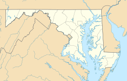
| Coordinates | 39°12′43″N 76°32′49″W / 39.212°N 76.547°W |
| River sources | Patapsco River |
| Max. width | 3,000 feet (910 m) |
| Average depth | 80 feet (24 m) |
| Salinity | Brackish |
| Shore length1 | 6,000 feet (1,800 m) |
| Frozen | Seasonal |
| Islands | 0 |
| Settlements | Baltimore |
| 1 Shore length is not a well-defined measure. | |
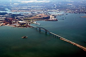
Thoms Cove is a special part of the Patapsco River in Baltimore, Maryland. It is also known as Thomas Cove. This natural cove is like a small, sheltered bay. It is about 1,500 feet (0.28 mi) wide.
Contents
Where is Thoms Cove Located?
Thoms Cove is found in an area called Hawkins Point, Baltimore. It sits on the northeastern side of a land area that sticks out into the water.
Nearby Waterways and Roads
- To the northeast, you'll find the Patapsco River. This river has tides, meaning its water level changes with the ocean.
- To the northwest is Curtis Bay, another part of the larger Patapsco River system.
- The land area of Hawkins Point is to the west.
- To the south, you can see I-695, a major highway.
What is Around Thoms Cove?
The cove is next to some important industrial areas.
Industrial Neighbors
- One side of Thoms Cove is bordered by a facility used by Eastalco Aluminum Company. This facility handles loading and storing materials.
- There is also a special type of landfill nearby. It is called a Superfund landfill. This means it's a place where old waste was buried, and now it is carefully managed to keep the environment safe and clean.
Who Manages Thoms Cove?
Most of Thoms Cove is looked after by the Maryland Port Administration. This group helps manage the ports and waterways in Maryland. They work to keep the area safe and running smoothly.

All content from Kiddle encyclopedia articles (including the article images and facts) can be freely used under Attribution-ShareAlike license, unless stated otherwise. Cite this article:
Thoms Cove Facts for Kids. Kiddle Encyclopedia.


