Thurman, Kansas facts for kids
Quick facts for kids
Thurman, Kansas
|
|
|---|---|

|
|
| Country | United States |
| State | Kansas |
| County | Chase |
| Elevation | 1,394 ft (425 m) |
| Population | |
| • Total | 0 |
| Time zone | UTC-6 (CST) |
| • Summer (DST) | UTC-5 (CDT) |
| Area code | 620 |
| GNIS ID | 482064 |
Thurman was once a small town in Chase County, Kansas. Today, it is known as a ghost town. This means it's a place where people used to live, but now no one does. Thurman was located in the beautiful, hilly area called the Flint Hills.
The Story of Thurman
Thurman was started in 1874. For a while, it was a busy little community. By 1900, more than 50 families lived there! The town had important places like a post office, stores where people could buy things, schools for children, and a church.
But over time, fewer and fewer people lived in Thurman. The town slowly became empty. By 1944, everyone had left, and Thurman became a ghost town.
The post office in Thurman was open for many years. It started on August 24, 1874, and closed on January 31, 1909.
Where Was Thurman Located?
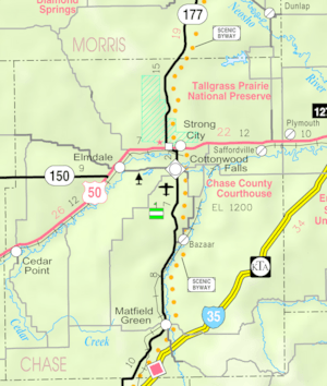
Thurman was in the southeastern part of Chase County, Kansas. It was about 1,394 feet (425 meters) above sea level. You can find its exact spot using these coordinates: 38°6′3″N 96°31′1″W / 38.10083°N 96.51694°W. Today, the area where Thurman once stood is part of Matfield Township.
 | Laphonza Butler |
 | Daisy Bates |
 | Elizabeth Piper Ensley |


