Tihuatlán (municipality) facts for kids
Quick facts for kids
Tihuatlán
|
||
|---|---|---|
|
City and municipality
|
||
|
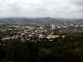
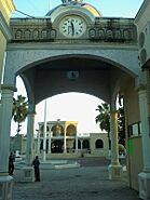
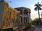
Top: Panoramic view of Tihuatlán; Middle: Statue of Christ the Redeemer at night, Juárez Park; Bottom:El Tajín National Airport, Identity Mural at Juárez Park
|
||
|
||
| Country | ||
| State | Veracruz | |
| Foundation | 1598 | |
| Area | ||
| • Total | 718.8 km2 (277.5 sq mi) | |
| Population
(2020)
|
||
| • Total | 92,276 | |
| • Density | 129/km2 (330/sq mi) | |
| • Seat | 15,305 | |
| Time zone | UTC-6 (CST) | |
| • Summer (DST) | UTC-5 (CDT) | |
| Website | Official Website: http://www.tihuatlan.gob.mx/ | |
| Historical population | ||
|---|---|---|
| Year | Pop. | ±% |
| 1995 | 81,660 | — |
| 2000 | 81,088 | −0.7% |
| 2005 | 80,923 | −0.2% |
| 2010 | 89,774 | +10.9% |
| 2015 | 96,418 | +7.4% |
| 2020 | 92,726 | −3.8% |
Tihuatlán is a city and a municipality in the northern part of the Mexican state of Veracruz. It is about 316 kilometers (196 miles) away from Xalapa, the capital city of Veracruz. The municipality covers an area of about 828.29 square kilometers (320 square miles). In 2020, about 92,726 people lived in the municipality. However, only about 16% of these people live in the main city area.
Contents
What's in a Name?
The name Tihuatlán comes from the Nahuatl language. It means "place of women."
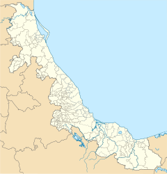
Where is Tihuatlán Located?
Tihuatlán is surrounded by other municipalities and a state.
- To the north, it borders Temapache and Tuxpan.
- To the east, you'll find Papantla, Poza Rica, and Cazones de Herrera.
- To the south, it's next to Coatzintla.
- To the southwest, it shares a border with the state of Puebla.
Rivers and Weather
Two rivers, the Cazones and Tontepec, flow through Tihuatlán. These rivers eventually empty into the Gulf of Mexico. The weather in Tihuatlán is warm and wet all year. It usually rains during the summer and autumn months.
What Grows in Tihuatlán?
Farmers in Tihuatlán primarily grow several important crops. These include maize (corn), beans, green chile, and oranges.
Local Celebrations
Tihuatlán has two main celebrations each year:
- In October, people celebrate in honor of Saint Francis of Assisi. He is considered the patron saint of the town.
- In December, there is a celebration for the Virgin of Guadalupe.
Getting Around
El Tajín National Airport is located right in Tihuatlán. This makes it easier for people to travel to and from the area by air.
See also
 In Spanish: Municipio de Tihuatlán para niños
 | Selma Burke |
 | Pauline Powell Burns |
 | Frederick J. Brown |
 | Robert Blackburn |


