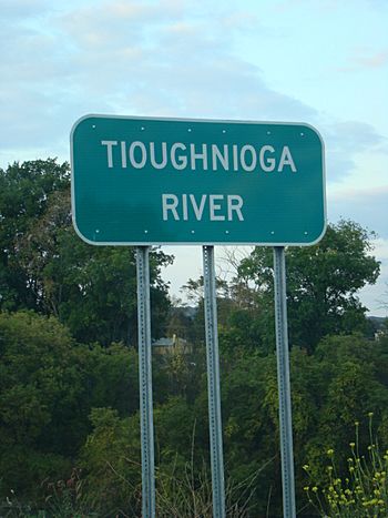
Tioughnioga River facts for kids
Quick facts for kids Tioughnioga River |
|
|---|---|
 |
|
| Native name | Ti-ough'-ni'-o-ga |
| Other name(s) | Tiohujodha, Onondaga |
| Country | United States |
| State | New York |
| County | Cortland, Broome County, New York |
| Physical characteristics | |
| Main source | East Branch Tioughnioga, West Branch Tioughnioga Cortland, New York 42°36′15″N 76°09′32″W / 42.60417°N 76.15889°W |
| River mouth | Chenango River Chenango Forks, New York 879 ft (268 m) 42°14′12″N 75°50′35″W / 42.23667°N 75.84306°W |
| Length | 34 mi (55 km) |
The Tioughnioga River is a river in central New York, United States. It is about 34 miles (55 km) long. This river flows into the Chenango River. It is part of the larger Susquehanna River system. The river flows through an area of hills and valleys.
The name "Tioughnioga" comes from a native word. It means "forks of the river" or "meeting of waters." The river has had other names too. Some people called it "Tiohujodha" or "Onondaga."
Contents
Where Does the Tioughnioga River Start?
The Tioughnioga River begins with two main parts. These parts are called branches. They are located southeast of Syracuse in upstate New York.
The West Branch of the River
The West Branch is about 15.6 miles (25.1 km) long. It starts at Tully Lake. This lake is about 2 miles (3 km) south of the village of Tully. The West Branch flows south from there.
How Tully Valley Was Formed
The Tully Valley was once a valley for a river that flowed north. This was before the Ice Age. During the Ice Age, a glacier blocked the valley. This created a lake. As the glacier melted, it left behind a lot of rock, gravel, and sand.
This material filled about half of the valley. It also made the river flow south instead of north. Today, there is a lot of gravel from Tully to Cortland. This gravel is used for building. It also holds a lot of water underground, forming an important aquifer.
Tully Lake itself is a special kind of lake. It is called a kettle lake. It formed when a large piece of ice was buried in the glacial debris. When the ice melted, the ground collapsed, making a lake.
The East Branch of the River
The East Branch is considered the main part of the river. It is about 21.4 miles (34.4 km) long. It starts in northeastern Cortland County. It begins where Tioughnioga Creek and the West Branch Tioughnioga Creek meet.
The East Branch flows southwest. It meets the West Branch of the Tioughnioga River at Cortland.
The River's Journey South
After the two branches join, the Tioughnioga River flows south-southeast. It receives water from the Otselic River at Whitney Point. Finally, it joins the Chenango River at Chenango Forks. This spot is about 10 miles (16 km) northeast of Binghamton.
What Are the Tioughnioga River's Tributaries?
A tributary is a smaller stream or river that flows into a larger one. The Tioughnioga River has many tributaries that feed into it.
- Halfway Brook
- Whitney Point Lake
- Jennings Creek
- Trout Brook
- West Branch Tioughnioga River
- Factory Brook
- East Branch Tioughnioga River
- Cheningo Creek
- Fabius Brook
- Carpenter Creek
- West Branch Tioughnioga Creek
- Tioughnioga Creek
- Middle Branch Tioughnioga Creek
- East Branch Tioughnioga Creek
Images for kids
 | Claudette Colvin |
 | Myrlie Evers-Williams |
 | Alberta Odell Jones |


