Tizi Ouzou Province facts for kids
Quick facts for kids
Tizi Ouzou Province
ولاية تيزي وزو
|
|
|---|---|

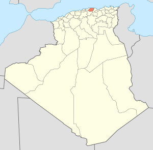
Map of Algeria highlighting Tizi Ouzou
|
|
| Country | |
| Capital | Tizi Ouzou |
| Area | |
| • Total | 3,568 km2 (1,378 sq mi) |
| Population
(2008)
|
|
| • Total | 1,119,646 |
| • Density | 313.80/km2 (812.74/sq mi) |
| Time zone | UTC+01 (CET) |
| Area Code | +213 (0) 26 |
| ISO 3166 code | DZ-15 |
| Districts | 21 |
| Municipalities | 67 |
Tizi Ouzou is a special area in Algeria, a country in North Africa. Think of it like a large state or region. It's named after its main city, which is also called Tizi Ouzou. This province is known for its beautiful mountains and rich culture. It's a place where many people speak the Amazigh language, also known as Berber.
Contents
About Tizi Ouzou Province
Tizi Ouzou Province is located in the northern part of Algeria. It covers an area of about 3,568 square kilometers. That's roughly the size of a small country! In 2008, over 1.1 million people lived here. The province is famous for its stunning natural beauty, including parts of the Djurdjura Mountains.
How the Province is Organized
Like many places, Tizi Ouzou Province is divided into smaller parts to help manage everything. These divisions make it easier for the government to provide services to everyone.
Districts and Municipalities
The province is split into 21 main areas called districts. Each district then has even smaller parts called communes or municipalities. There are 67 of these municipalities in total. These smaller areas help local people have a say in how their communities are run.
Here are the 21 districts of Tizi Ouzou Province:
- Aïn El Hammam
- Azazga
- Azzefoun
- Béni Douala
- Béni Yenni
- Boghni
- Bouzeguène
- Draâ Ben Khedda
- Draâ El Mizan
- Iferhounène
- Larbaâ Nath Irathen
- Maâtka
- Makouda
- Mekla
- Ouadhia
- Ouacif
- Ouaguenoun
- Tigzirt
- Tizi Gheni
- Tizi
- Tizi Rached
See also
 In Spanish: Provincia de Tizi Uzu para niños
 | Jackie Robinson |
 | Jack Johnson |
 | Althea Gibson |
 | Arthur Ashe |
 | Muhammad Ali |

