Tracy, Iowa facts for kids
Quick facts for kids
Tracy, Iowa
|
|
|---|---|
| Country | United States |
| State | Iowa |
| County | Marion |
| Elevation | 784 ft (239 m) |
| Time zone | UTC-6 (Central (CST)) |
| • Summer (DST) | UTC-5 (CDT) |
| ZIP codes |
50256
|
| GNIS feature ID | 463551 |
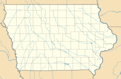
Tracy is a small, unincorporated community located in eastern Marion County, Iowa, United States. An "unincorporated community" means it's a group of homes and businesses that isn't officially a city or town with its own local government.
You can find Tracy along local roads, just east of the city of Knoxville. Knoxville is important because it's the county seat of Marion County. This means it's where the main government offices for the county are located. Tracy sits about 784 feet (239 meters) above sea level.
Even though Tracy isn't an official city, it has its own post office. This post office helps people send and receive mail, and it uses the special ZIP code 50256. The Tracy post office first opened a long time ago, on January 31, 1876. The community of Tracy itself was planned and created in October 1875 by two people: Captain Alexander F. Tracy and S. Merrill.
Education in Tracy
Students living in Tracy attend public schools that are part of the Twin Cedars Community School District. This school district is responsible for providing education to children in the area.
 | Stephanie Wilson |
 | Charles Bolden |
 | Ronald McNair |
 | Frederick D. Gregory |


