
Knoxville, Iowa facts for kids
Quick facts for kids
Knoxville
|
|
|---|---|

"Knoxville" sign found on the north side along IA 14
|
|

Location of Knoxville, Iowa
|
|
| Country | |
| State | |
| County | Marion |
| Area | |
| • Total | 4.62 sq mi (11.97 km2) |
| • Land | 4.62 sq mi (11.96 km2) |
| • Water | 0.00 sq mi (0.01 km2) |
| Elevation | 909 ft (277 m) |
| Population
(2020)
|
|
| • Total | 7,595 |
| • Density | 1,644.65/sq mi (635.03/km2) |
| Time zone | UTC-6 (Central (CST)) |
| • Summer (DST) | UTC-5 (CDT) |
| ZIP codes |
50138, 50197, 50198
|
| Area code(s) | 641 |
| FIPS code | 19-42015 |
| GNIS feature ID | 2395559 |
| Website | www.knoxvilleia.gov |

Knoxville is a city in Marion County, Iowa, United States. It is the main city of the county, also known as the county seat. In 2020, about 7,595 people lived there. This was a small increase from the 7,313 people who lived there in 2010.
Knoxville is famous for the National Sprint Car Hall of Fame & Museum. This museum is right next to the exciting Knoxville Raceway dirt track.
Contents
History of Knoxville
The city of Knoxville was chosen as the main city for Marion County. Its location was picked because it was close to the center of the county. It also had flat land and good timber nearby.
The first plots of land in Knoxville were sold in 1845. The city was named after another small town in Iowa.
Railroads Arrive in Knoxville
In 1853, people in Marion County wanted to bring railroads to Knoxville. They promised to buy shares in any railroad company that reached the town.
The first railroad to arrive was the Muscatine, Oskaloosa & Council Bluffs line. This line was suggested in 1868. By 1875, when it reached Knoxville, it was known as the Chicago, Burlington & Quincy Railroad.
The second railroad was the Chicago, Rock Island & Pacific. This line finished building its tracks from Oskaloosa to Knoxville in 1876.
Coal Mining in the Area
Coal mining started in Marion County around 1874 or 1875. The Union Coal Company opened a mine in Flagler, about 4 miles (6.4 km) east of Knoxville.
For several years, the Number 5 mine in Flagler was very busy. It was one of the most productive mines in Iowa. About 150 men worked there, digging coal from a vein over 8 feet (2.5 m) thick. The Oak Hill coal company also had mines in Flagler.
Soon after the railroad came to Knoxville, J. T. James opened a coal mine in the city itself. This mine was just 8 blocks north of the courthouse. It continued to operate until 1890. Another nearby mine was run by W. A. Gamble.
In the 1880s, the White Breast Fuel Company opened the Number 11 mine at Flagler. This mine worked in a coal vein that was up to 14 feet (4.3 m) thick in some places. The mine kept going until 1892, but the coal got thinner as they dug further.
Population of Knoxville
| Historical population | |||
|---|---|---|---|
| Census | Pop. | %± | |
| 1860 | 1,124 | — | |
| 1870 | 800 | −28.8% | |
| 1880 | 2,577 | 222.1% | |
| 1890 | 2,632 | 2.1% | |
| 1900 | 3,131 | 19.0% | |
| 1910 | 3,190 | 1.9% | |
| 1920 | 3,523 | 10.4% | |
| 1930 | 4,697 | 33.3% | |
| 1940 | 6,936 | 47.7% | |
| 1950 | 7,625 | 9.9% | |
| 1960 | 7,817 | 2.5% | |
| 1970 | 7,755 | −0.8% | |
| 1980 | 8,143 | 5.0% | |
| 1990 | 8,232 | 1.1% | |
| 2000 | 7,731 | −6.1% | |
| 2010 | 7,313 | −5.4% | |
| 2020 | 7,595 | 3.9% | |
| Iowa Data Center | |||
2020 Census Information
In 2020, the census showed 7,595 people living in Knoxville. There were 3,239 households, which are groups of people living together. About 1,886 of these were families.
The city had about 1,644 people per square mile (635 per km2). Most residents, 92.3%, were White. Other groups included 1.5% Black, 0.5% Native American, and 0.5% Asian. About 2.4% of the population was Hispanic or Latino.
About 27.1% of households had children under 18 living with them. The average age in Knoxville was 41.3 years old. About 25.0% of residents were under 20 years old.
2010 Census Information
In 2010, the census counted 7,313 people in Knoxville. There were 3,169 households. The population density was about 1,579 people per square mile (610 per km2).
Most people, 96.9%, were White. About 1.1% were African American. About 1.9% of the population was Hispanic or Latino.
About 30.5% of households had children under 18. The average age in the city was 41 years. About 24.7% of residents were under 18 years old.
Geography of Knoxville
Knoxville is located in the south-central part of Iowa. It is about 2 miles (3.2 km) east of White Breast Creek. It is also 6 miles (9.7 km) southwest of where White Breast Creek meets the Des Moines River. This meeting point is in Lake Red Rock.
According to the United States Census Bureau, Knoxville covers a total area of 4.63 square miles (11.99 km2). All of this area is land.
Education in Knoxville
The Knoxville Community School District is in charge of the public schools in the city.
Famous People from Knoxville
Many notable people have connections to Knoxville:
- Robert L. Burns (1929–1945), a member of the Los Angeles City Council.
- George Kruck Cherrie, a naturalist and explorer, was born in Knoxville.
- James Fee, a photographer.
- Dixie Cornell Gebhardt, who designed the Flag of Iowa.
- Joseph P. Graw, a businessman and Minnesota state representative.
- Edward R. Hays (1890–1891), a U.S. representative.
- James Mathews, a U.S. representative and professor at Iowa State College.
- Howard B. Myers, an economist.
- Frank Steunenberg (1897–1901), who was the governor of Idaho.
- Edward C. Stone (1991–2001), a director of NASA Jet Propulsion Laboratory.
- William M. Stone (1864–1868), who was the governor of Iowa.
- William Corwin Stuart, an attorney and judge.
- Jon Thorup, a member of the Iowa House of Representatives.
- Henry Carroll Timmonds, a Missouri state representative and judge in the late 1800s.
Images for kids
-
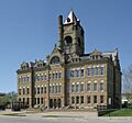
Marion County Courthouse

See also
 In Spanish: Knoxville (Iowa) para niños
