Transportation in Richmond, Virginia facts for kids
Richmond, Virginia, is a city with a long history of getting people and goods from one place to another. This article explores how people and things move around Richmond and its nearby areas. We'll look at travel by land, sea, and air. Richmond is an independent city, but it's also connected to parts of Henrico and Chesterfield counties. These areas are often called the "Richmond area."
Contents
How Richmond's Transportation Changed Over Time
Early Travel: Rivers and Canals
Richmond's transportation story began way back in the 1600s. The early Virginia Colony, started in Jamestown in 1607, relied on rivers for trade. Plantations along the James River, like John Rolfe's Varina Farms, had their own docks. They shipped tobacco and other goods overseas.
Richmond and its old neighbor Manchester (now part of Richmond) grew up as ports on the James River. They were at the "fall line," where rivers become too shallow for big boats. So, people built canals to bypass the rapids. This allowed boats to travel further upstream. As roads and railroads developed, these ports became places where goods were moved from boats to land transport.
The first stagecoach lines came to Richmond during the War of 1812. Steamboat service on the James River began in 1815. In the early 1800s, Virginia started funding projects to improve transportation. This led to canals like the James River and Kanawha Canal. It also led to early railroads like the Chesterfield Railroad and many toll roads.
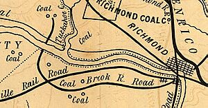
By 1855, Richmond had railroads going in many directions. These included the Richmond and Danville Railroad, the Virginia Central Railroad, and the Richmond and Petersburg Railroad. There was also a line north to Potomac Creek, connecting to steamboats that went to Alexandria and Baltimore.
Civil War and Railroads
During the American Civil War, Richmond was the capital of the Confederate States. Its railroads were super important for getting supplies to the city. Union ships couldn't reach Richmond by river because of defenses at Drewry's Bluff. So, the rail lines through Petersburg became key. Union General Ulysses S. Grant tried to cut these lines during the Siege of Petersburg. When Petersburg fell in April 1865, the Confederate government had to leave Richmond. The war ended soon after.
Rebuilding and New Connections
After the Civil War, Richmond's transportation quickly bounced back. Improvements and new projects continued. Claudius Crozet's tunnels through the Blue Ridge Mountains became part of the Chesapeake and Ohio Railroad. This railroad connected eastern Virginia to the Ohio River Valley by 1873. By 1881, coal from the mountains was shipped by train through Richmond to Newport News for export. The James River and Kanawha Canal was even turned into a railroad line.
Electric Streetcars Arrive
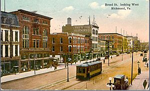
Richmond was home to the first successful electric streetcar system in the United States! Frank J. Sprague designed it, and the first line opened in January 1888. Richmond's hilly landscape was a great place to test this new technology. Soon, electric trolleys replaced horse-drawn cars.
These electric streetcars helped Richmond grow a lot. To get people to ride, amusement parks were built at the end of the lines. Streetcar lines also connected Richmond to nearby towns like Ashland, Chester, Petersburg, and Hopewell. Many neighborhoods, like Highland Park and Ginter Park, grew up along these streetcar routes.
In 1945, a company bought the streetcar network and quickly replaced it with buses.
Early 1900s: Bridges and Train Stations
In 1910, Manchester joined with Richmond. A big part of this deal was that a "free bridge" over the James River would always be kept open. The James River became a central part of the bigger Richmond. Besides the two free bridges downtown, new toll bridges were built to the west. These included the Westham Bridge (1911), the Boulevard Bridge (1927), and the Robert E. Lee Memorial Bridge (1934).
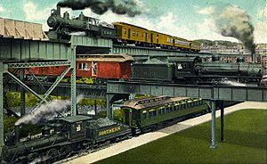
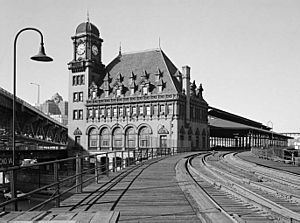
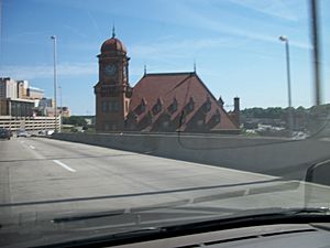
Two new main train stations opened in Richmond in the early 1900s. Richmond's Main Street Station was built in 1901. It was designed in the French Renaissance style. A new Broad Street Station was built in 1917. This was a huge station that served several railroads. Passenger service to Broad Street Station stopped in 1975. Today, it's the Science Museum of Virginia. Main Street Station was renovated and started serving Amtrak trains again in 2003.
In 1927, Richard Evelyn Byrd Flying Field (now Richmond International Airport) opened. Famous aviator Charles Lindbergh even visited for the dedication! The airport was named after Richard E. Byrd, a famous explorer from Virginia.
The Age of Cars: Highways and Expressways
Also in 1927, Virginia's State Highway Department (now VDOT) was created. By World War II, a network of highways connected Richmond to other places.
As roads got better, streetcars couldn't compete with cars and buses. By 1939, the interurban streetcar services were gone. The last local streetcars stopped running in 1949.
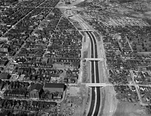
After World War II, the Jefferson Davis Memorial Highway became very crowded. It had only four lanes and was dangerous. In 1955, before the U.S. Interstate Highway System, Virginia created the Richmond-Petersburg Turnpike Authority. This agency built a new toll road called the Richmond-Petersburg Turnpike. It opened in 1958 and later became part of Interstate 95 (I-95). Local drivers could buy cheaper toll tickets. The Turnpike became completely free to use on July 1, 1992.
The Richmond Metropolitan Authority (RMA) was formed in 1966. The RMA built and opened the Powhite Parkway (1973) and the Downtown Expressway (1976) as toll roads. The RMA also bought the Boulevard Bridge. Today, the RMA runs three of Richmond's toll roads and bridges. It also owns The Diamond, a sports stadium.
Public bus systems replaced the streetcars. But as fewer people rode, these bus lines started to lose money. By the early 1970s, most suburban lines were gone. The inner-city company became the government-owned Greater Richmond Transit (GRTC) in 1972.
Toll Roads and Smart Tags
Richmond's toll roads now use electronic toll collection. The Boulevard Bridge used to have special license plate strips or decals for commuters. The Richmond-Petersburg Turnpike also had cheaper rates for local drivers. In 1987, the RMA started using toll tokens for the Powhite Parkway and Downtown Expressway.
In 1999, the RMA and VDOT started using the Smart Tag system for electronic toll collection. This system became compatible with E-ZPass in 2004.
Today, these toll roads are in the Richmond area:
- Downtown Expressway in Richmond.
- Powhite Parkway and Powhite Parkway Extension in Richmond and Chesterfield County.
- Boulevard Bridge (sometimes called the "Nickel Bridge," but it costs 35 cents now) in Richmond.
- Pocahontas Parkway in Chesterfield and Henrico County.
Highways and Bridges
Richmond has a big network of highways and expressways.
The main east-west highway is Interstate 64 (I-64). The main north-south highway is Interstate 95 (I-95).
Other important Interstates are I-195 (Beltline Expressway) and I-295.
Another road, I-895, is currently called State Route 895 and is a toll road. It's also known as the Pocahontas Parkway.
The Richmond Metropolitan Authority runs the Downtown Expressway and the Powhite Parkway, which are toll roads. State Route 76, also a toll road, is the Powhite Parkway Extension.
Richmond's "Outer Beltway"
Richmond doesn't have a formal "beltway" like some other big cities. But it has several roads that act like one. These roads help drivers go around the downtown area and travel between suburbs.
These highways include:
- Interstate 295 (25 miles long).
- State Route 288 (30.7 miles long).
If you combine these with parts of I-95, I-64, and State Route 895 (Pocahontas Parkway), you get a "virtual beltway" about 70 miles long. The only tolls on this virtual beltway would be on the State Route 895 part, which includes the tall Vietnam Veterans Memorial Bridge over the James River.
Major U.S. Highways
Here are some major U.S. highways in the Richmond area:
- US 1 (Washington Highway and Jefferson Davis Highway).
- US 33.
- US 60 (Williamsburg Road and Midlothian Turnpike).
- US 250 (Broad Street and Broad Street Road).
- US 301 (Chamberlayne Ave and Jefferson Davis Highway).
- US 360 (Mechanicsville Turnpike and Hull Street Road).
Major Bridges
The James River cuts through the middle of the Richmond area. Here are some of the bridges that cross the James River:
- World War II Veterans Memorial Bridge (VA-288).
- Edward E. Willey Bridge (VA-150).
- Huguenot Memorial Bridge (VA-147).
- Powhite Parkway Bridge (Powhite Parkway and VA-76) (toll bridge).
- Boulevard Bridge (VA-161) (toll bridge).
- Robert E. Lee Memorial Bridge (US-1 and US-301).
- Manchester Bridge (US-60).
- Mayo Bridge (US-360).
- Interstate 95 James River Bridge (I-95).
- Vietnam Veterans Memorial Bridge (Pocahontas Parkway and VA-895) (toll bridge).
- Varina-Enon Bridge (I-295).
Local Public Transportation
Bus Rapid Transit
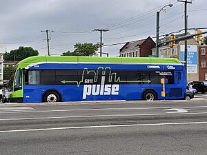
Since 2018, Richmond has a special bus line called GRTC Pulse. It's a "bus rapid transit" line that runs along Broad and Main Streets. It's like a train, but with buses! It goes from Willow Lawn in Henrico County to Rockets Landing in eastern Richmond. This was the first rapid transit system in the city in almost 60 years.
Bus and Paratransit Systems
The Greater Richmond Transit Company (GRTC) provides public bus service in the Richmond area. It gets money from the government and local cities. GRTC is managed by a private company.
Public transportation in Richmond is somewhat limited. GRTC bus routes mainly serve the city limits and nearby parts of Henrico and Chesterfield counties. Service in Henrico is only on weekdays. In Chesterfield, there are only two express routes during rush hour. Other areas like Hanover County don't have bus service.
GRTC also has express buses to Petersburg. There, you can connect to Petersburg Area Transit, which serves the Tri-Cities area.
GRTC also offers a special service called CARE for people with disabilities.
Future Rail Transit
Richmond is thinking about building a small streetcar system in the downtown area.
There's also an organization called the Central Virginia Transportation Authority (CVATA). They want to bring commuter rail, light rail, and even a historic streetcar system to the Richmond area. These main lines would be called Central Virginia Express.
Taxis and Airport Limousines
Richmond has many taxi companies. There are also services that provide limousines, SUVs, and cars for individuals and groups. These services can take you to the airport or other cities in Virginia.
Intercity Bus Services
You can catch buses to other cities from the terminal at 2910 N Boulevard. Some of the companies include:
- Greyhound Lines
- New Century Travel (to New York, Washington, D.C., Philadelphia)
- Today's Bus (to New York)
- Eastern Shuttle (to New York)
- Apex (to New York)
- Megabus.com (express service to many cities like Washington D.C., Philadelphia, Atlanta, and New York)
Railroads
Passenger Trains
The Richmond area has two train stations served by Amtrak. Both stations have regular service from cities north of Richmond, like Washington, D.C., Philadelphia, and New York. The Staples Mill Road Station is outside the city. It gets all trains going north and south, including those to Florida.
Richmond's only train station inside the city is the historic Main Street Station. It was updated in 2004. As of 2010, it only serves trains going to and from Newport News and Williamsburg. Because of this, Staples Mill Road station serves more trains and passengers.
Virginia is also studying ways to improve passenger train service. There are plans for high-speed rail lines connecting to the Northeast Corridor and the Southeast High Speed Rail Corridor.
Freight Trains
Richmond is served by two major freight railroad companies: Norfolk Southern (NS) and CSX. The city also has the Buckingham Branch Railroad, which is Virginia's largest short line railroad. Train yards in Richmond include NS's Ship Yard and CSX's Fulton Yard.
Air Travel
Richmond has a major commercial airport and several smaller airports for private planes. Richmond International Airport (RIC) is located in Sandston, about seven miles southeast of Richmond. It's also less than an hour's drive from historic Williamsburg. RIC has flights from seven airlines to 21 non-stop destinations. You can also get connecting flights to places all over the world. In 2004, about 2.5 million passengers used the airport.
Richmond International Airport isn't served by regular public buses, except for a few GRTC routes during weekday rush hours. So, driving to the airport (by taxi or private car) is the fastest way to get there. A taxi from downtown Richmond costs about $15. Parking is available in long-term lots, daily garages, and hourly garages.
Smaller airports for private planes are also available. These include Chesterfield County Airport and Hanover County Airport.
Ports and Waterways
The Port of Richmond (also called Deepwater Terminal) is on the James River. It has deep water connections that go east to Hampton Roads. Hampton Roads is known as the "world's greatest natural harbor" and is only 18 miles from the Atlantic Ocean. You can also ship goods to other places on the Chesapeake Bay.
The old canals in Richmond are no longer used for shipping. However, parts of them downtown are now part of the Canal Walk. Upstream, parts of the canals are used for the city's water systems. You can see a set of old locks in a small park near Tobacco Row.
|
 | George Robert Carruthers |
 | Patricia Bath |
 | Jan Ernst Matzeliger |
 | Alexander Miles |


