
Turbotville, Pennsylvania facts for kids
Quick facts for kids
Turbotville Borough, Pennsylvania
|
|
|---|---|
|
Borough
|
|

Pennsylvania Route 44 in Turbotville
|
|

Location of Turbotville in Northumberland County, Pennsylvania.
|
|

Turbotville, Pennsylvania
Location in Pennsylvania

Turbotville, Pennsylvania
Location in the United States
|
|
| Country | United States |
| State | Pennsylvania |
| County | Northumberland |
| Settled | 1850 |
| Incorporated | 1858 |
| Government | |
| • Type | Municipal Government |
| • Body | Borough Council |
| Area | |
| • Total | 0.45 sq mi (1.17 km2) |
| • Land | 0.45 sq mi (1.17 km2) |
| • Water | 0.00 sq mi (0.00 km2) |
| Elevation
(center of borough)
|
575 ft (175 m) |
| Highest elevation
(southwestern part of borough)
|
600 ft (200 m) |
| Lowest elevation
(tributary to Warrior Run at northwestern end of borough)
|
530 ft (160 m) |
| Population
(2020)
|
|
| • Total | 677 |
| • Density | 1,501.11/sq mi (579.15/km2) |
| Time zone | UTC−5 (Eastern (EST)) |
| • Summer (DST) | UTC−4 (EDT) |
| ZIP Code |
17772
|
| Area code(s) | 570 |
| FIPS code | 42-77832 |
Turbotville Borough is a small town, also called a borough, located in Northumberland County, Pennsylvania, in the United States. In 2020, about 677 people lived there. It's known for its quiet community and local history.
Contents
Turbotville's Location and Size
Turbotville is found in the north-central part of Pennsylvania, near the Upper Susquehanna River. It is the northernmost town in Northumberland County. The town is completely surrounded by Lewis Township.
The borough covers a total area of about 0.4 square miles (1.2 square kilometers), and all of this area is land.
A Look Back: Turbotville's History
How Turbotville Began
A long time ago, much of the land where Turbotville now stands was owned by Jacob Sechler and his wife, Catherine. They received this land from Governor Thomas Penn, who was the son of William Penn, a famous founder of Pennsylvania. The Sechlers called their land "Green Lawn."
The first settlement here was called Snydertown. It was named after Philip Reifsnyder, who was one of the first European-American settlers. Philip was a blacksmith. He built a tavern, which was like an inn or restaurant, and his wife ran it. He also had his blacksmith shop nearby.
From Tributville to Turbotville
Before it became an official borough, the town's name changed to Tributville. Later, the spelling became Turbotville, which is how it is known today. The town was named after Colonel Turbutt Francis. He was a military officer who received a large piece of land called the "Colonel's Reward" for his service in wars. This land included much of the area south of Turbotville.
Becoming an Official Borough
In 1858, the people living in Tributville asked the Northumberland County Court to make their town an official borough. This meant it would have its own local government. On January 3, 1859, the court agreed, and Turbotville officially became a borough. The exact date when the spelling changed from Tributville to Turbotville is not known.
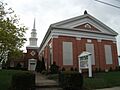
Faith and Community: Turbotville's Churches
Churches have always been an important part of the Turbotville community. Many early churches were connected to the backgrounds of the people who lived there. For example, Zion Evangelical Lutheran Church, Trinity United Church of Christ, and St. James Lutheran Church (now Holy Spirit Lutheran Church) were all started by people of German heritage. The Turbotville Baptist Church was for people of British-American heritage.
Today, Zion and Trinity churches still have active groups of members in the borough. Holy Spirit Lutheran Church moved to a new building outside the borough. The old Turbotville Baptist Church building was taken down many years ago. A new Baptist church, Bethel Baptist Church, was built nearby and also has a strong community.
Who Lives in Turbotville?
Population Changes Over Time
| Historical population | |||
|---|---|---|---|
| Census | Pop. | %± | |
| 1860 | 380 | — | |
| 1870 | 417 | 9.7% | |
| 1880 | 414 | −0.7% | |
| 1890 | 441 | 6.5% | |
| 1900 | 390 | −11.6% | |
| 1910 | 365 | −6.4% | |
| 1920 | 415 | 13.7% | |
| 1930 | 456 | 9.9% | |
| 1940 | 523 | 14.7% | |
| 1950 | 518 | −1.0% | |
| 1960 | 612 | 18.1% | |
| 1970 | 627 | 2.5% | |
| 1980 | 675 | 7.7% | |
| 1990 | 675 | 0.0% | |
| 2000 | 691 | 2.4% | |
| 2010 | 705 | 2.0% | |
| 2020 | 677 | −4.0% | |
| U.S. Decennial Census | |||
In 2000, there were 691 people living in Turbotville. About 278 households and 190 families made up the town. Most of the people living there were White.
Families and Age Groups
Many households in Turbotville have children under 18 living at home. Over half of the households were married couples living together.
The population includes people of all ages. About 28% of the residents were under 18 years old. The median age was 34 years, meaning half the people were younger than 34 and half were older.
Income and Economy
In 2000, the average income for a household in Turbotville was about $40,221 per year. For families, the average income was around $43,750. A small number of families and people lived below the poverty line.
Fun and Leisure in Turbotville
Turbotville Community Park
The Turbotville Community Park is a great place for residents to relax and play. It has a picnic area, tennis courts, and a playground. The Turbotville Community Hall and the old Turbotville Train Station are also located at the park.
Turbotville Auto Museum
A notable place to visit in Turbotville is the Turbotville Auto Museum. It's a special spot for anyone interested in cars and their history.
Learning in Turbotville: Schools and Education
Turbotville is part of the Warrior Run School District. This school district is unique because it covers parts of three different counties in Pennsylvania: Northumberland, Montour, and Union counties.
The Turbotville Elementary School is located right in the borough. The Middle School and High School are located nearby in Lewis Township.
History of Turbotville Schools
The first Turbotville High School was a wooden building on Church Street. Later, a new brick high school was built on Pine Street in 1937. This building is now used as the Turbotville Elementary School.
In 1958, a new high school was built. Then, in 1968, another new high school was completed. The older high school building was then changed to become the Warrior Run Middle School.
Images for kids
-
Church in Turbotville
.jpg)
See also
 In Spanish: Turbotville para niños
