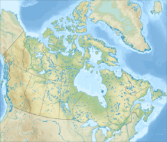
Turgeon River (rivière des Hurons) facts for kids
Quick facts for kids Turgeon River |
|
|---|---|
| Native name | Rivière Turgeon |
| Country | Canada |
| Province | Quebec |
| Administrative region | Capitale-Nationale |
| MRC | La Jacques-Cartier Regional County Municipality |
| Municipality | Stoneham-et-Tewkesbury |
| Physical characteristics | |
| Main source | Demers Lake Stoneham-et-Tewkesbury 686 units? 47°03′51″N 71°13′58″W / 47.06429°N 71.23290°W |
| River mouth | Rivière des Hurons Stoneham-et-Tewkesbury 352 m 47°03′29″N 71°17′59″W / 47.05806°N 71.29972°W |
| Length | 6.9 km (4.3 mi) |
| Basin features | |
| River system | Saint Lawrence River |
| Tributaries |
|
The Turgeon River is a river in Quebec, Canada. It flows through a place called Stoneham-et-Tewkesbury, which is north of Quebec City. It's part of the La Jacques-Cartier Regional County Municipality in the Capitale-Nationale area.
Forest roads help people reach the upper parts of the river valley.
The Turgeon River usually freezes over from early December to late March. However, it's safest to be on the ice from late December to early March. The river's water level changes with the seasons and how much it rains. The biggest flood usually happens in March or April.
Where the Turgeon River Flows
The Turgeon River starts at Demers Lake. This lake is about 0.9 kilometres (0.56 mi) long and sits at an altitude of 686 metres (2,251 ft) in a forest and mountain area. There's a small marshy part at the north end of the lake.
The start of the river (Demers Lake) is located:
- About 5.1 kilometres (3.2 mi) northeast of where the Turgeon River meets the Hurons River.
- About 5.9 kilometres (3.7 mi) northeast of the center of Saint-Adolphe village.
- About 7.5 kilometres (4.7 mi) northwest of the village center of Sainte-Brigitte-de-Laval.
- About 11.9 kilometres (7.4 mi) northeast of the center of Stoneham village.
From Demers Lake, the Turgeon River flows for about 6.9 kilometres (4.3 mi). It drops 334 metres (1,096 ft) in height along its path. Here's how it flows:
- For 2.9 kilometres (1.8 mi), it goes southwest, making a curve to the east. It then flows through Lake Turgeon, which is 0.7 kilometres (0.43 mi) long and at an altitude of 352 metres (1,155 ft). This small lake also has a marshy area on its east side.
- Next, for 2.8 kilometres (1.7 mi), it continues southwest, passing a mountain that is 684 metres (2,244 ft) high. It picks up a small stream from the southeast.
- Finally, for 1.2 kilometres (0.75 mi), it flows northwest with a steep drop. It then joins the rivière des Hurons.
After joining the Hurons River, the water flows for 21.1 kilometres (13.1 mi) down the Hurons River. Then, it crosses Lake Saint-Charles for 5.0 kilometres (3.1 mi) to the southeast. After that, the water flows for 33.8 kilometres (21.0 mi) generally southeast and northeast, following the Saint-Charles River. The Saint-Charles River then flows into the Saint Lawrence River.
Naming the Turgeon River
The name "Rivière Turgeon" was officially given on August 2, 1974. This was done by the Commission de toponymie du Québec, which is like a special group that names places in Quebec.
 | Stephanie Wilson |
 | Charles Bolden |
 | Ronald McNair |
 | Frederick D. Gregory |


